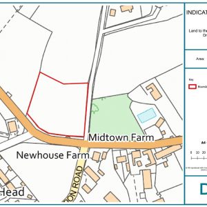
Development Land to the North of Station Road, Drigg
Drigg, Holmrook, Cumbria CA19 1XH
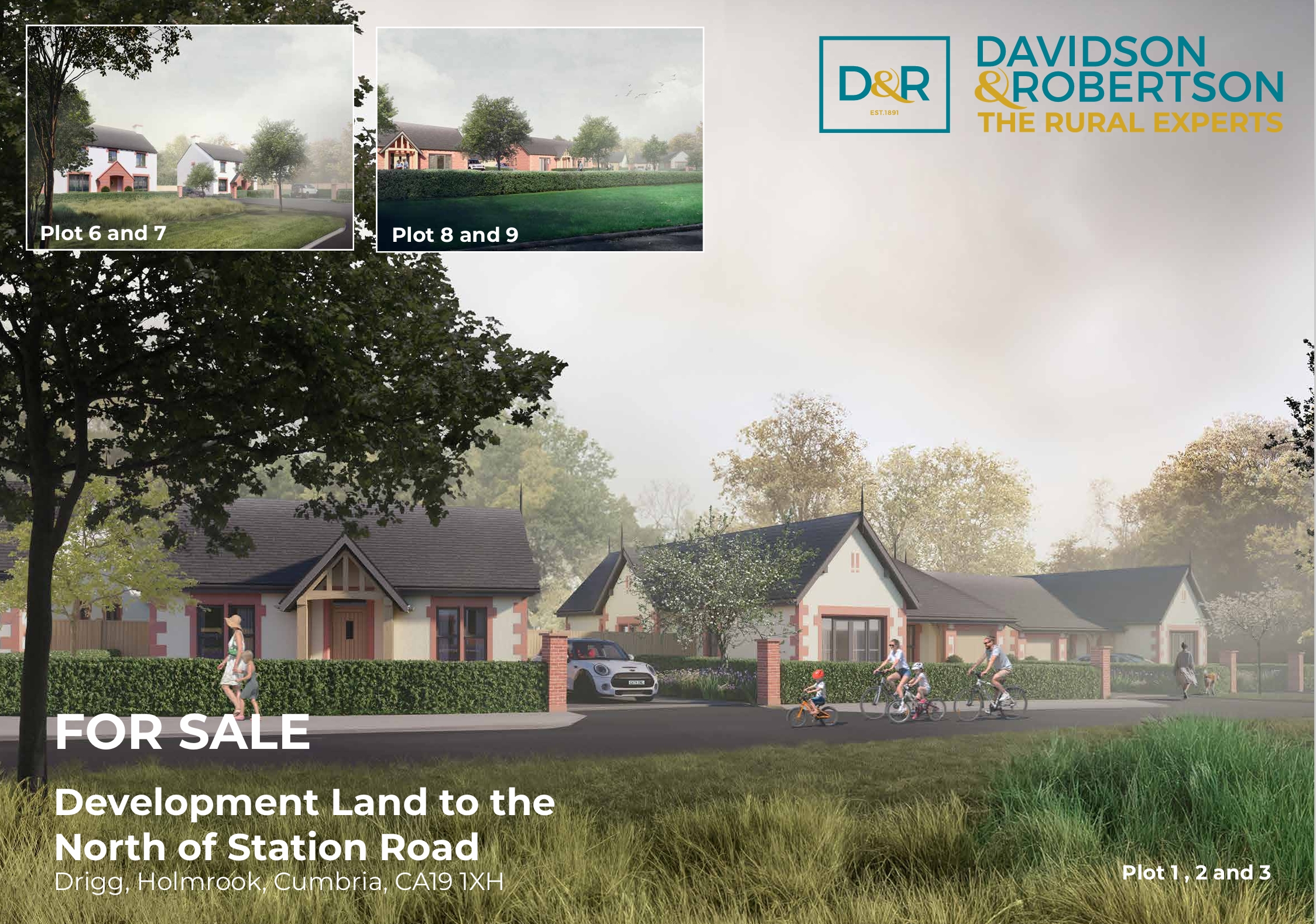
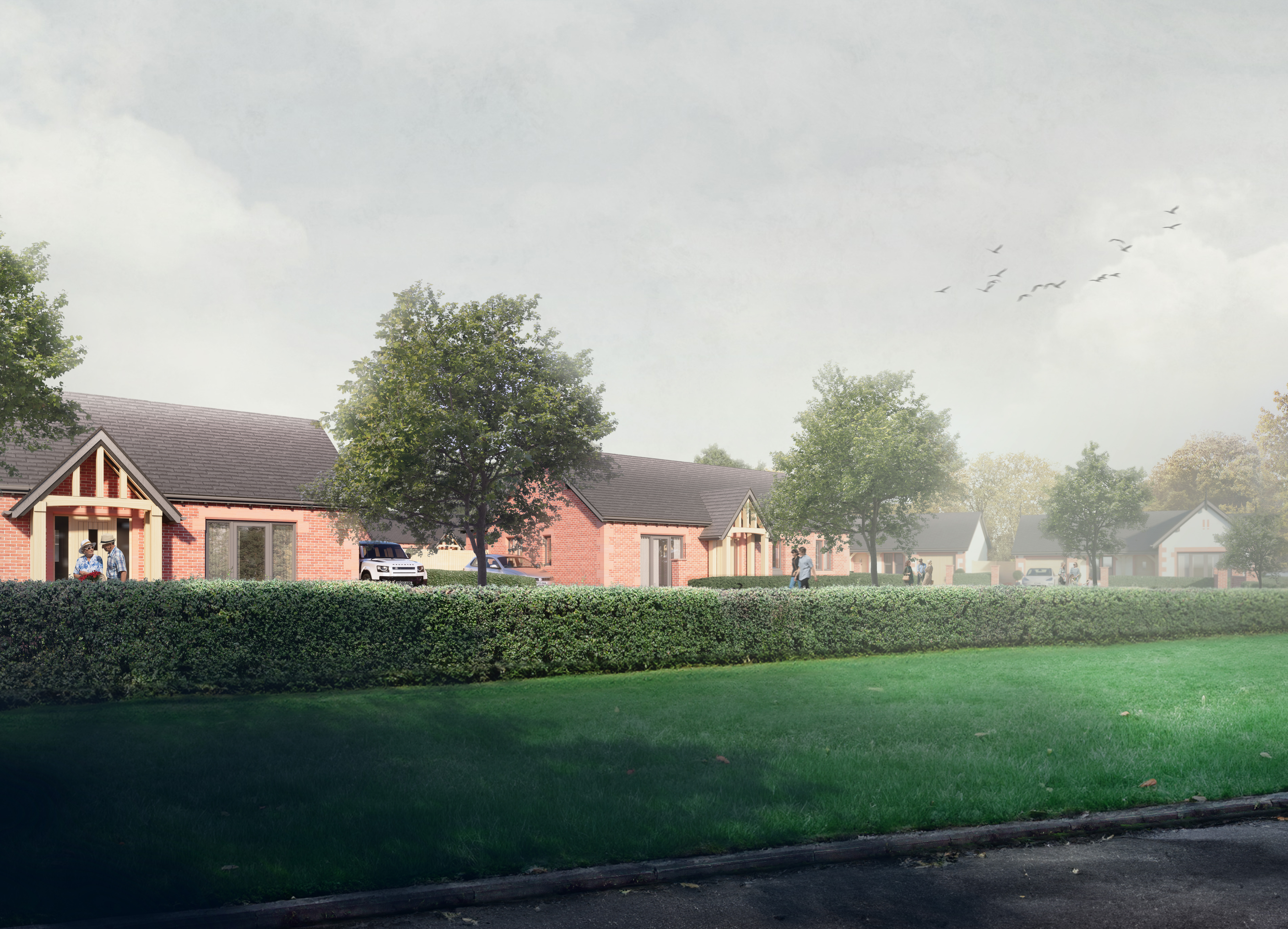
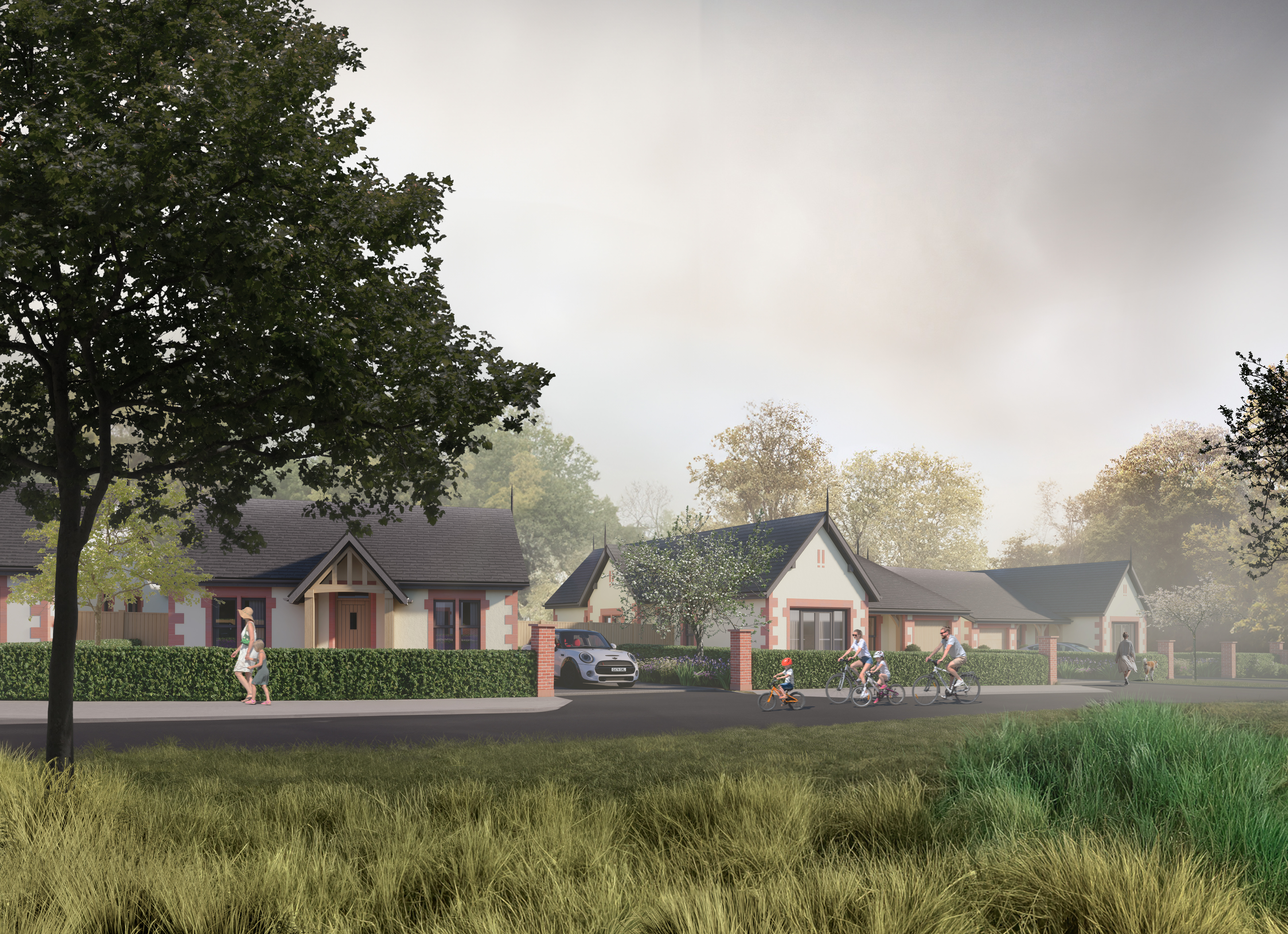
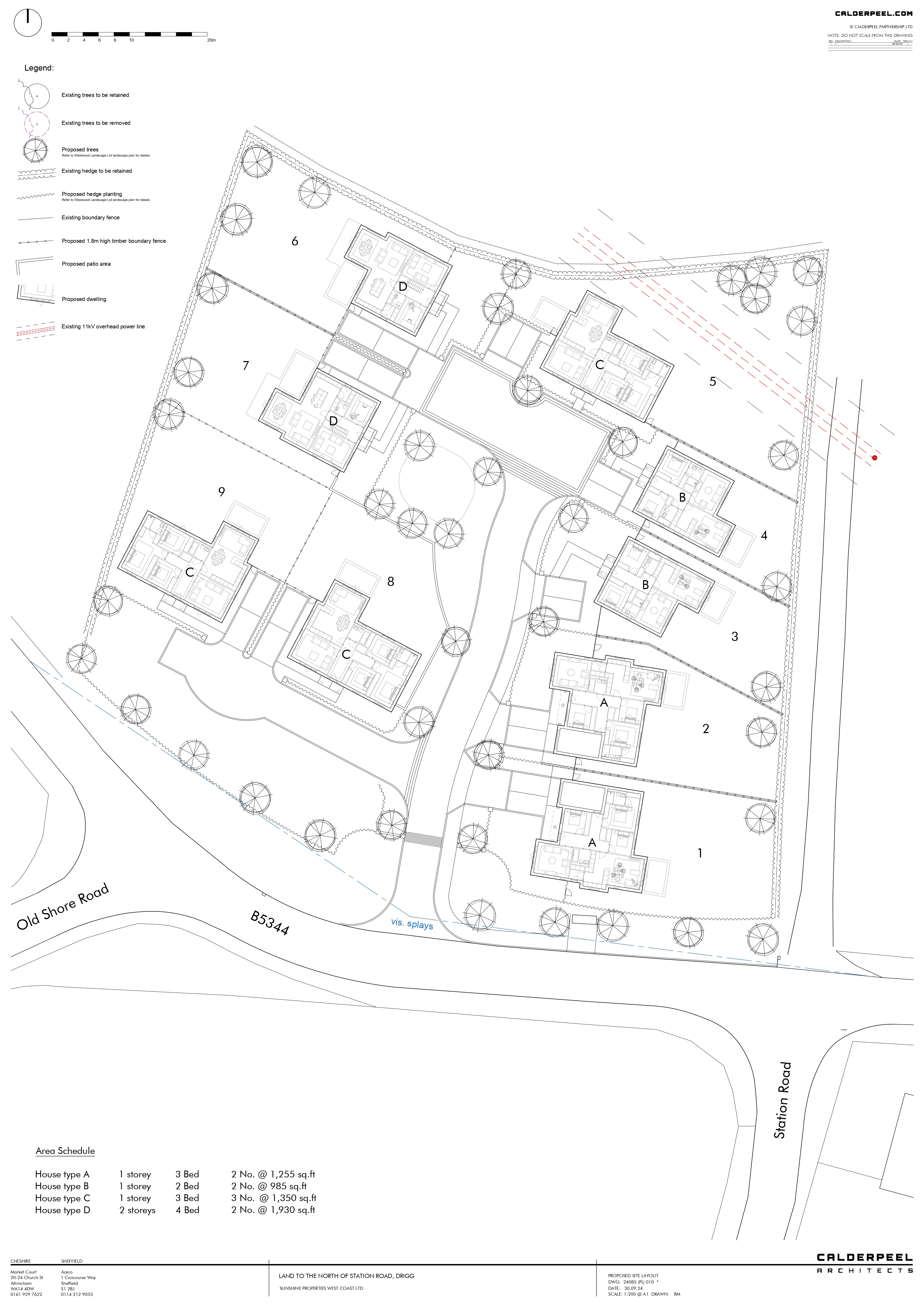
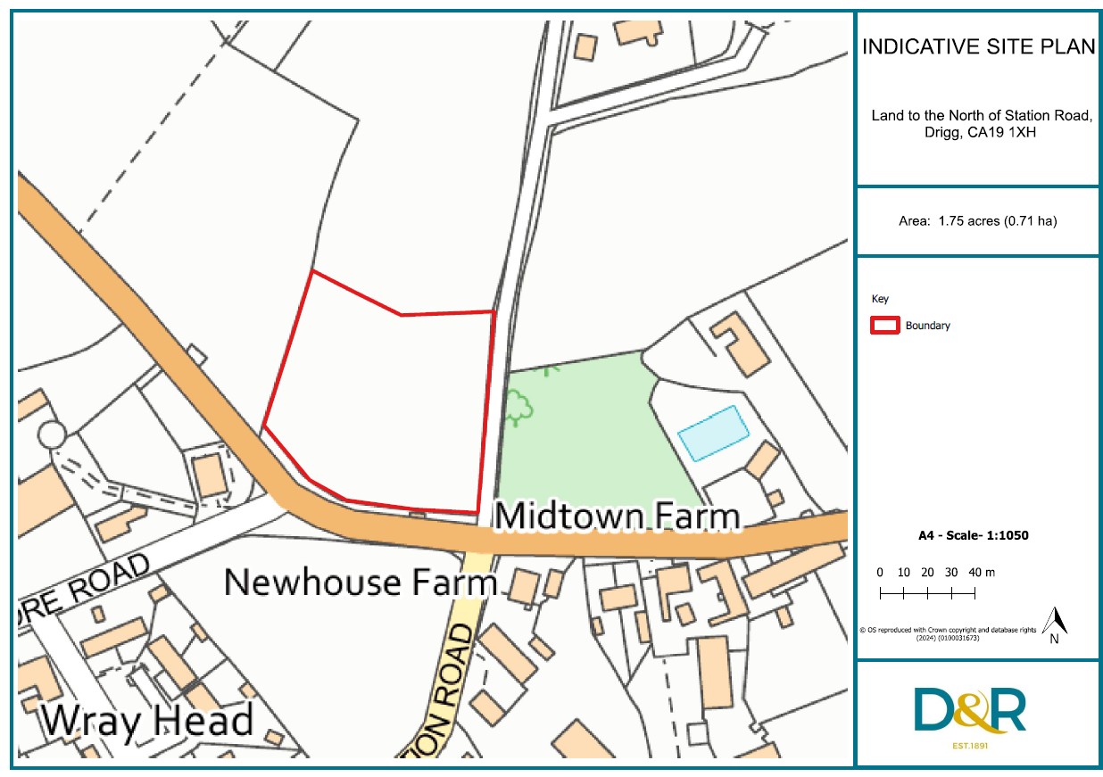
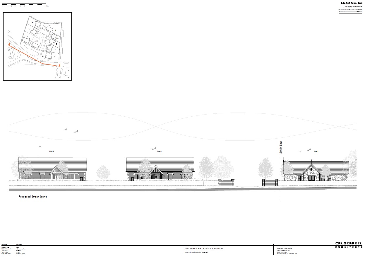
An exciting opportunity to acquire land with full detailed planning permission in place for nine dwellings extending to 1.75 acres (0.71 hectares) or thereby to the North of Station Road in Drigg, Cumbria.
- Roadside access
- Full detailed planning permission for residential development of nine dwellings
- Rural village location
- 5 miles from Sellafield
Self Build Plots Now Also Available - Prices Range from £80,000 To £100,000. Please get in touch to register your interest!
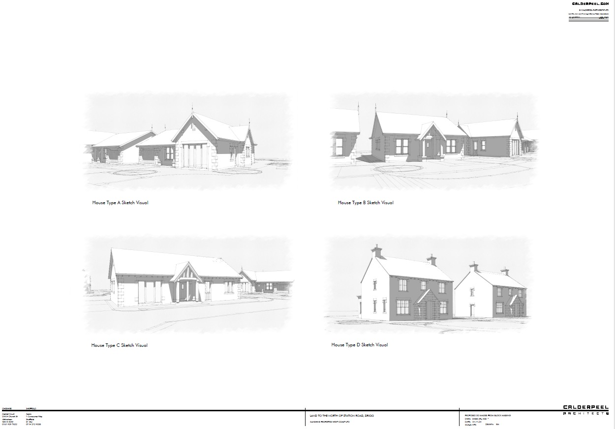
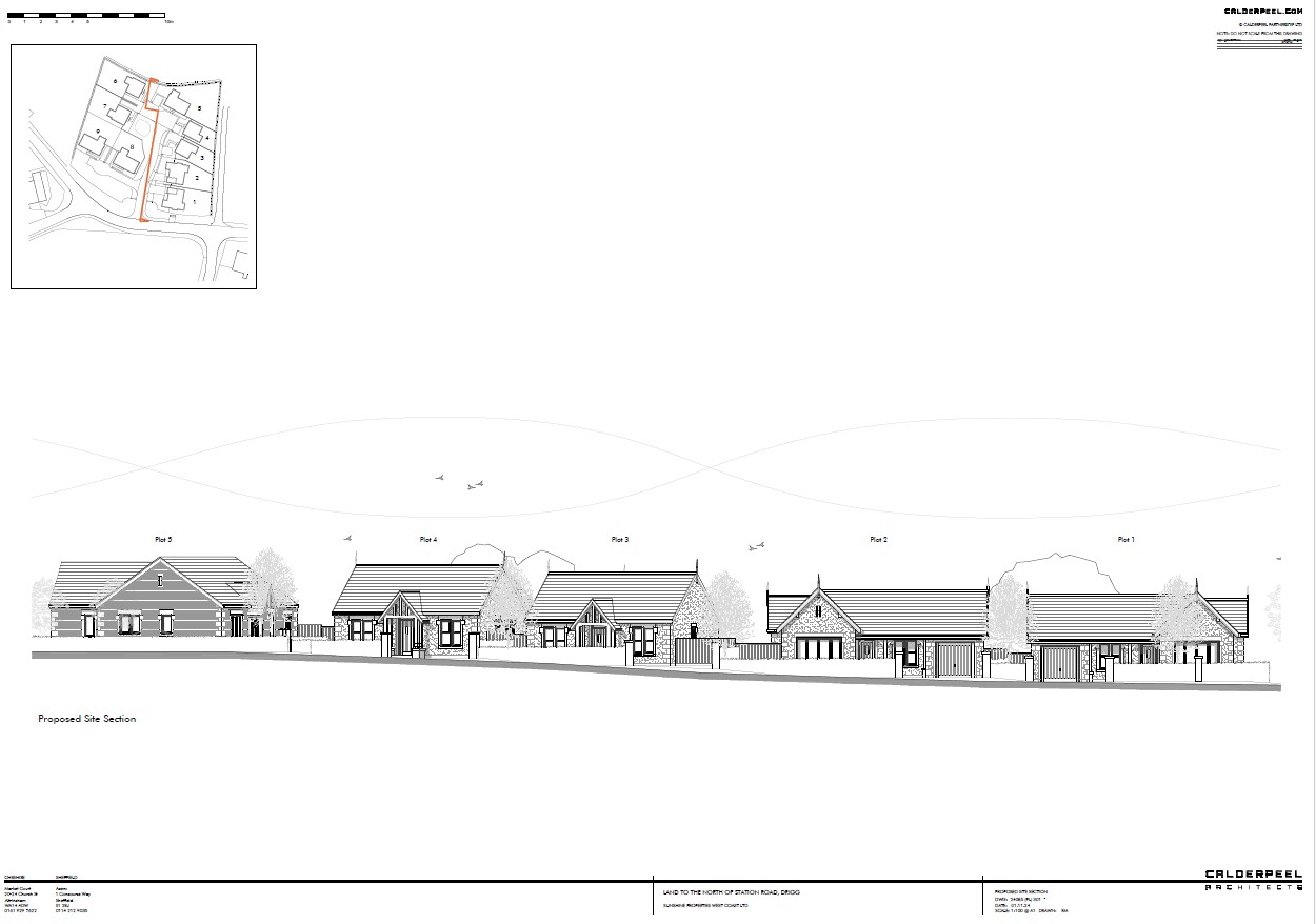
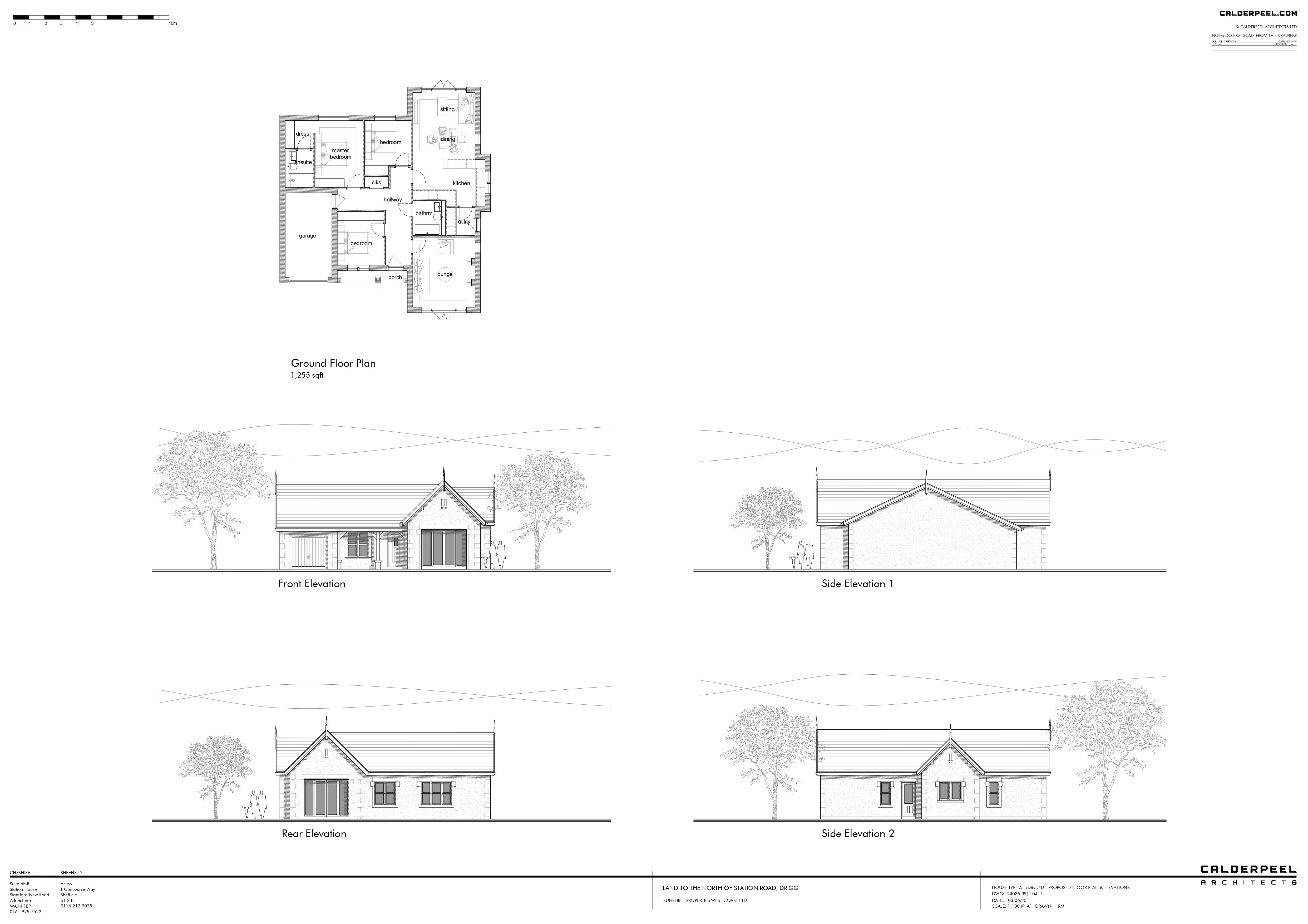
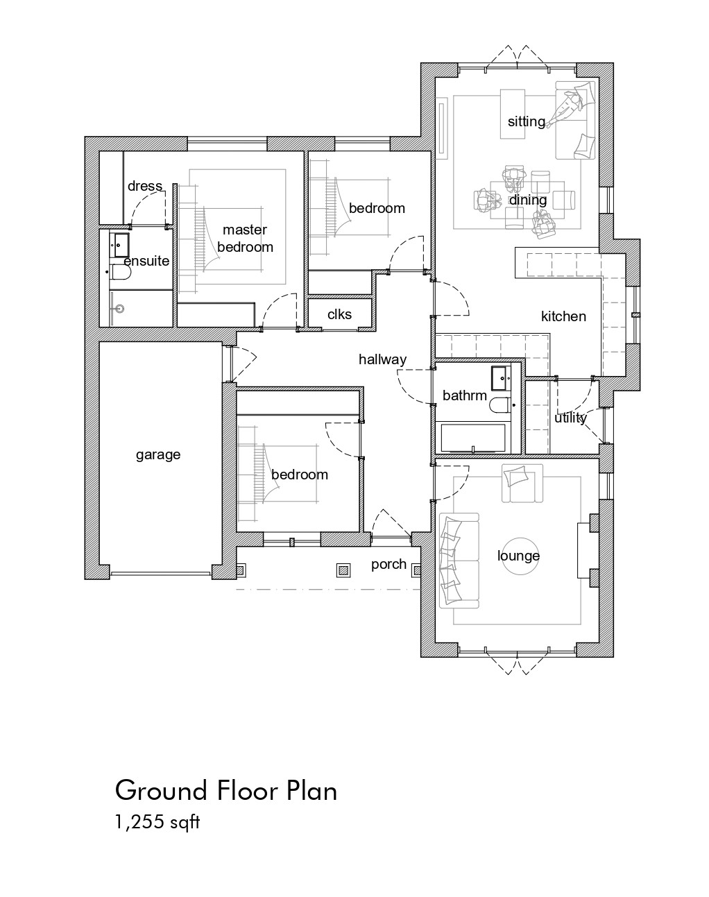
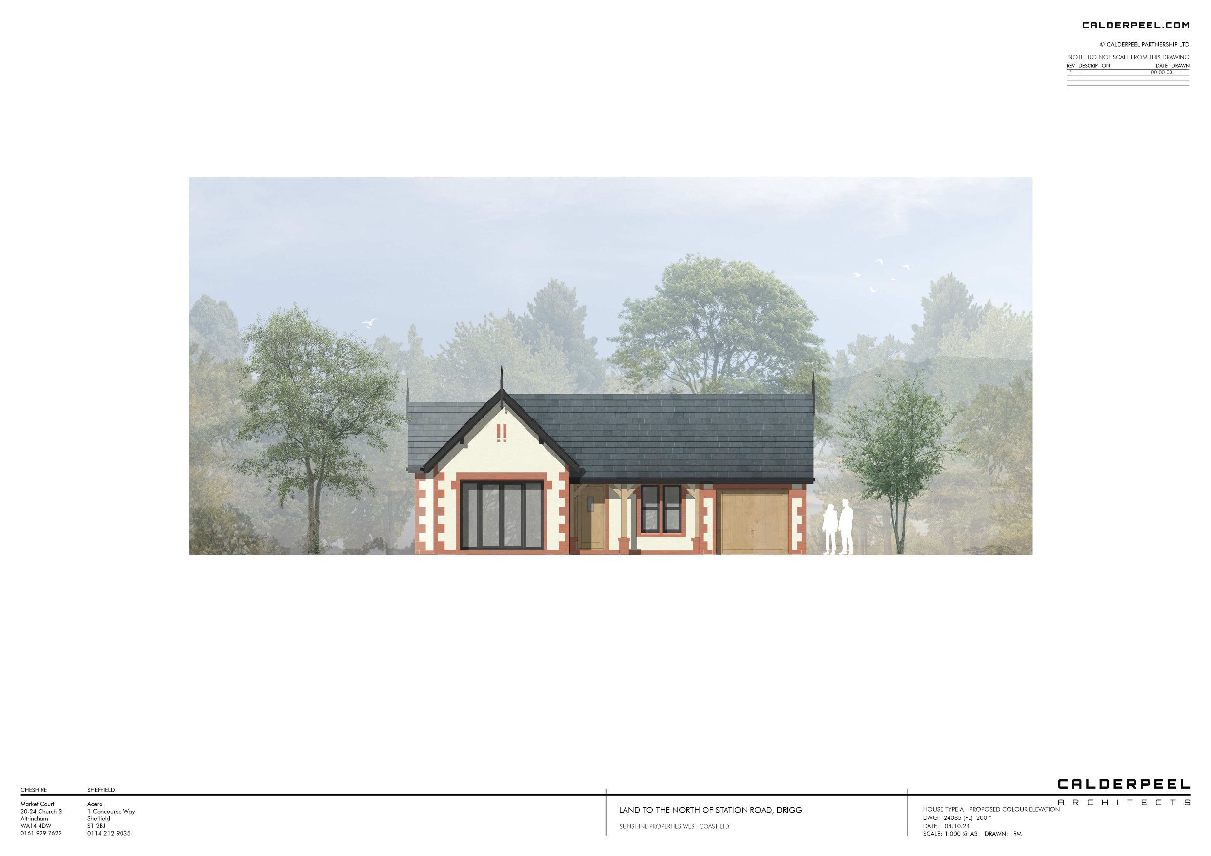
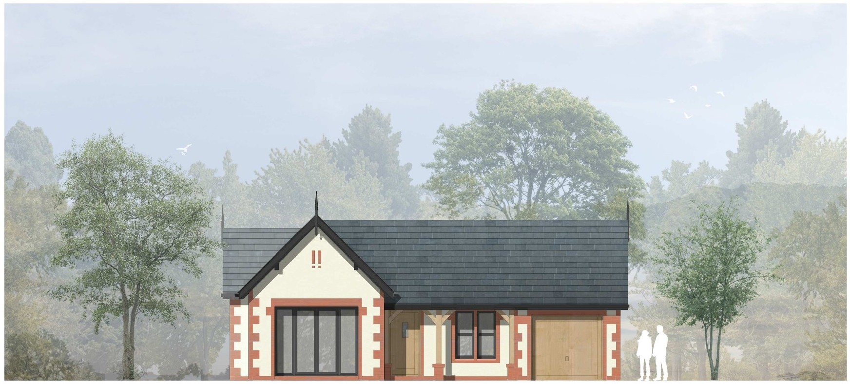
Plot 1 - House Type A (3 bed with garage) 1,255 sq ft Guide Price £90,000
Plot 2 - House Type A (3 bed with garage) 1,255 sq ft Guide Price £80,000
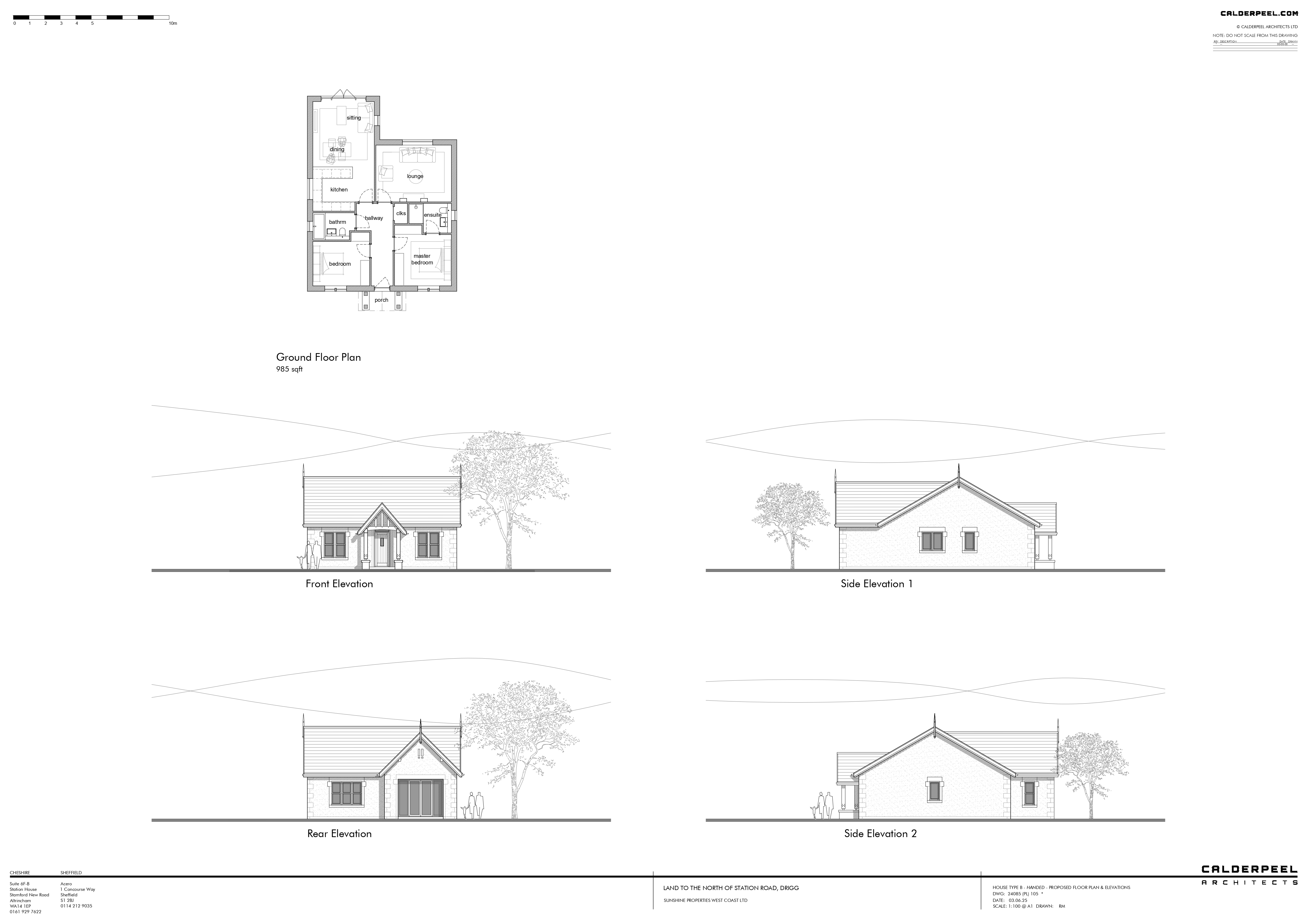
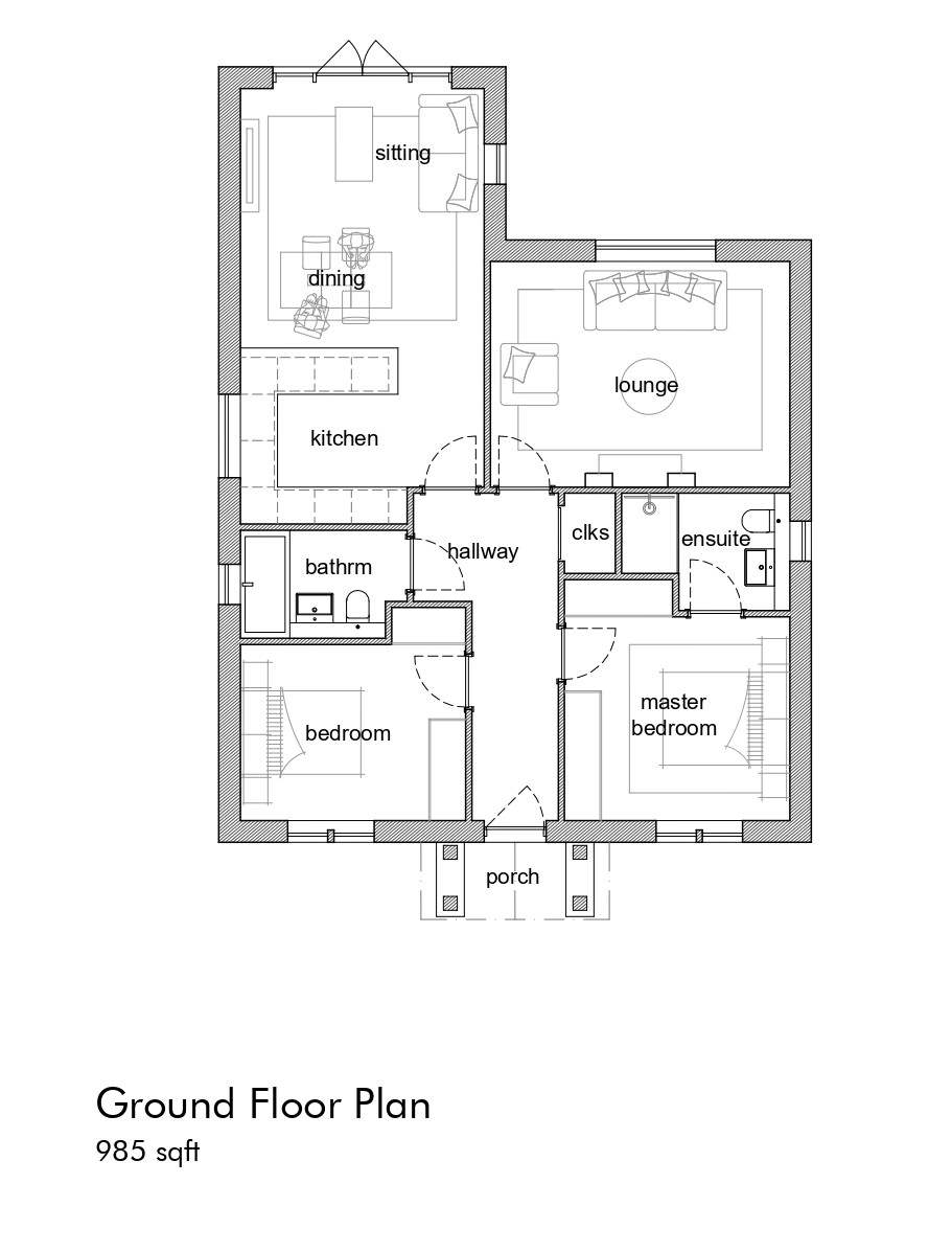
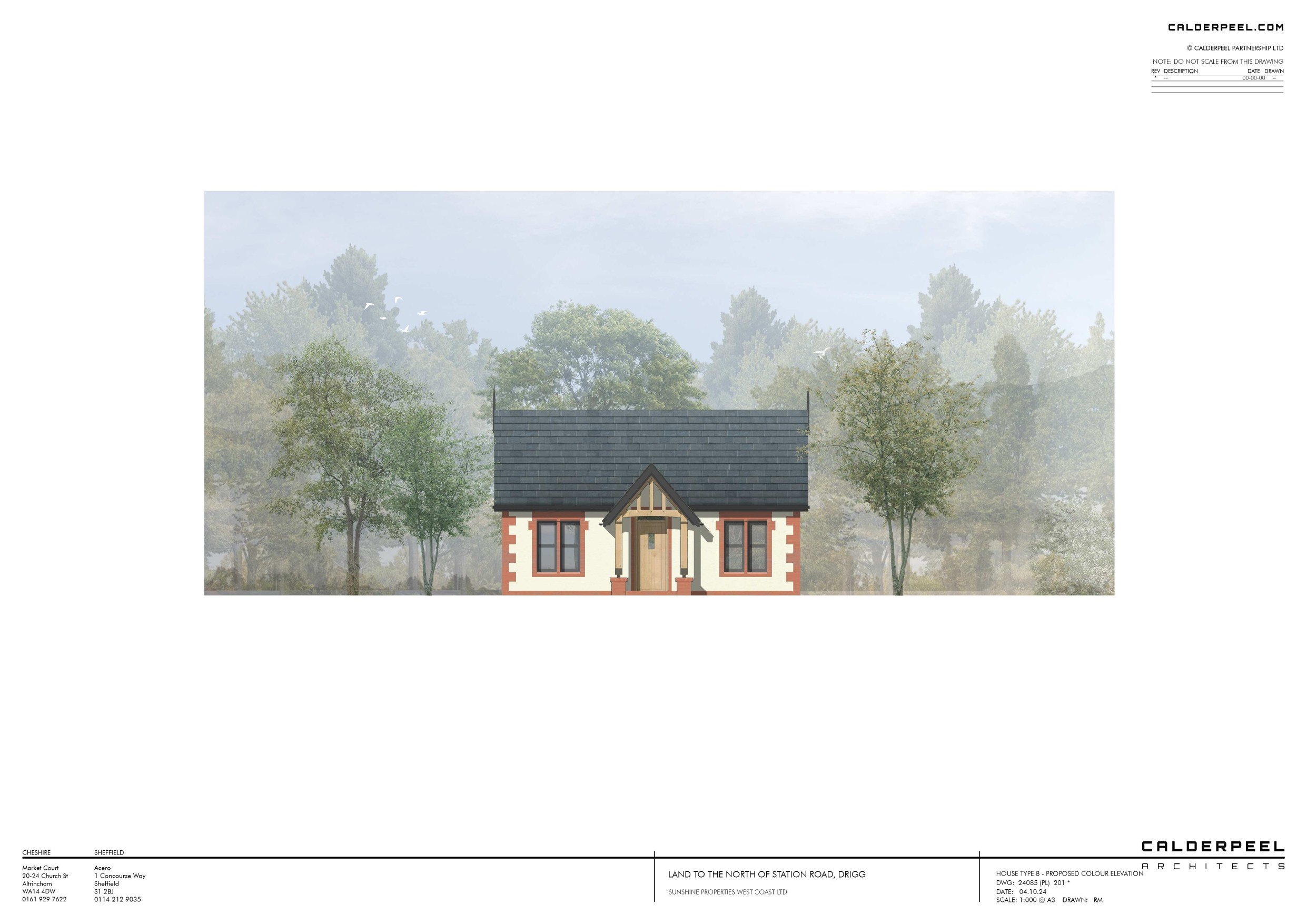
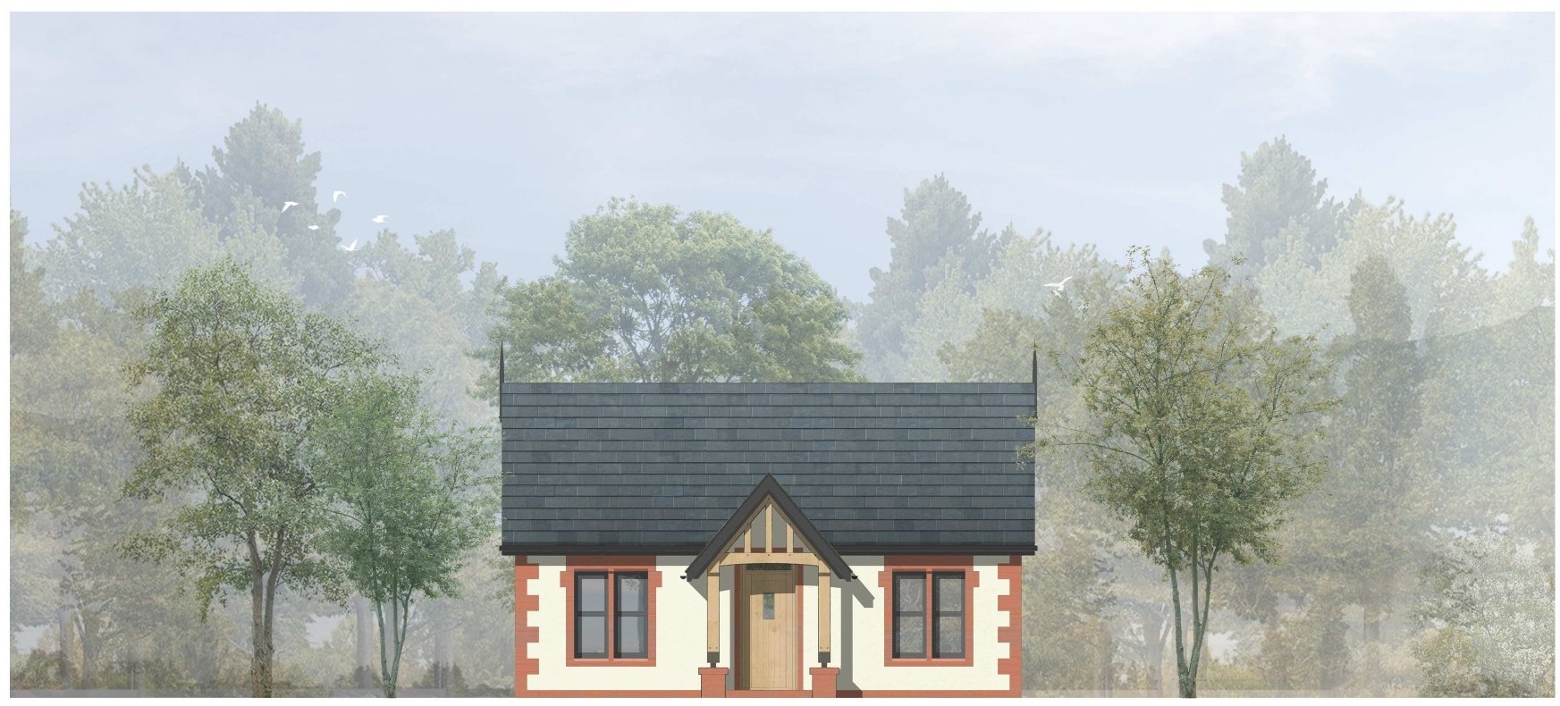
Plot 3 - House Type B (2 bed bungalow) 985 sq ft Guide Price £80,000
Plot 4 - House Type B (2 bed bungalow) 985 sq ft Guide Price £80,000
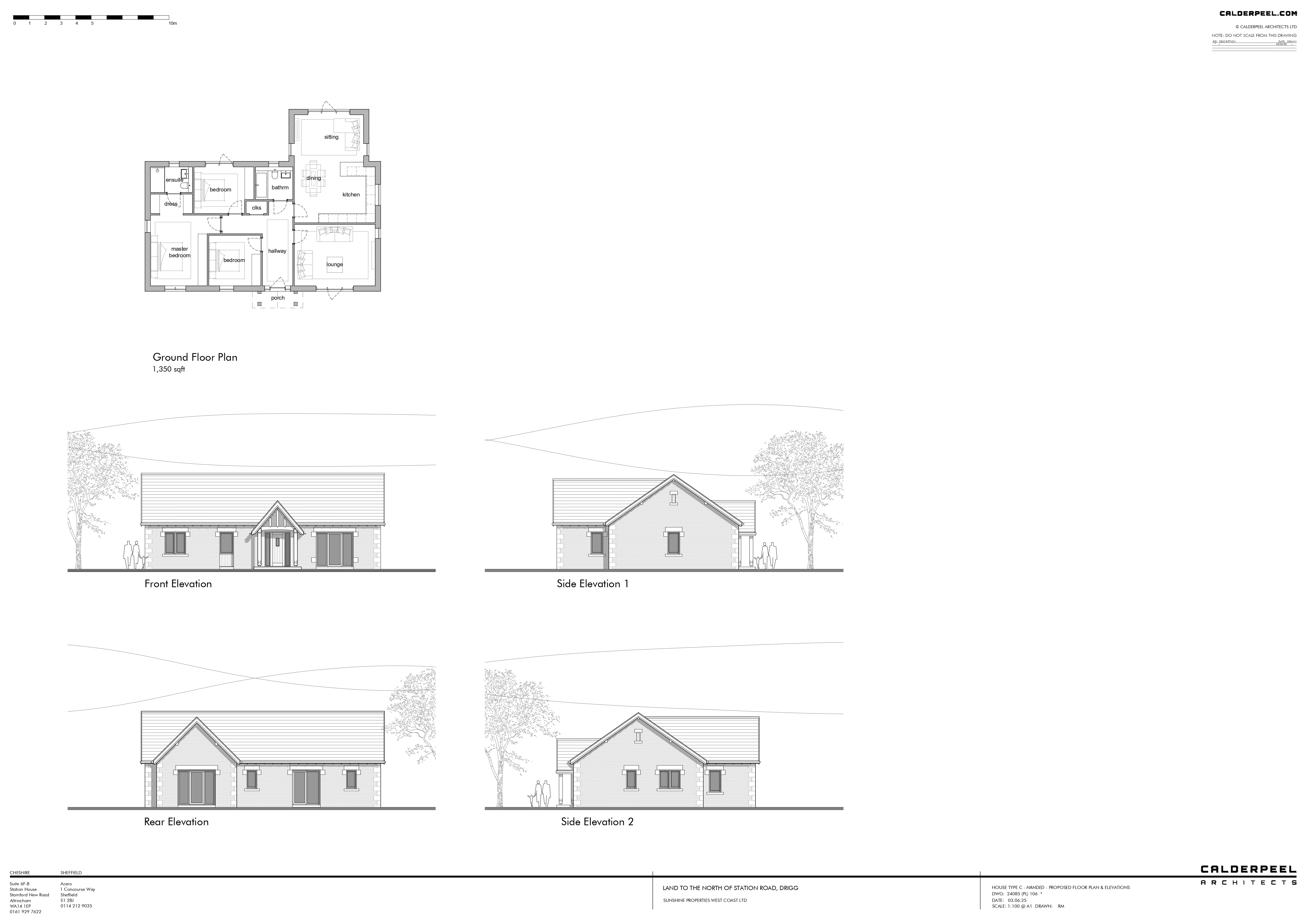
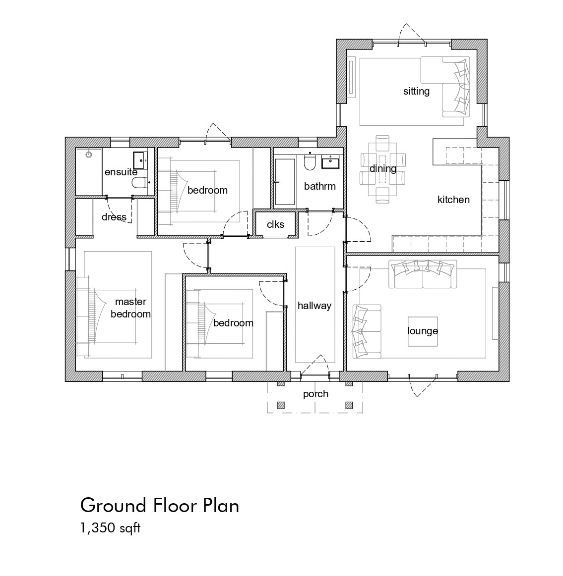
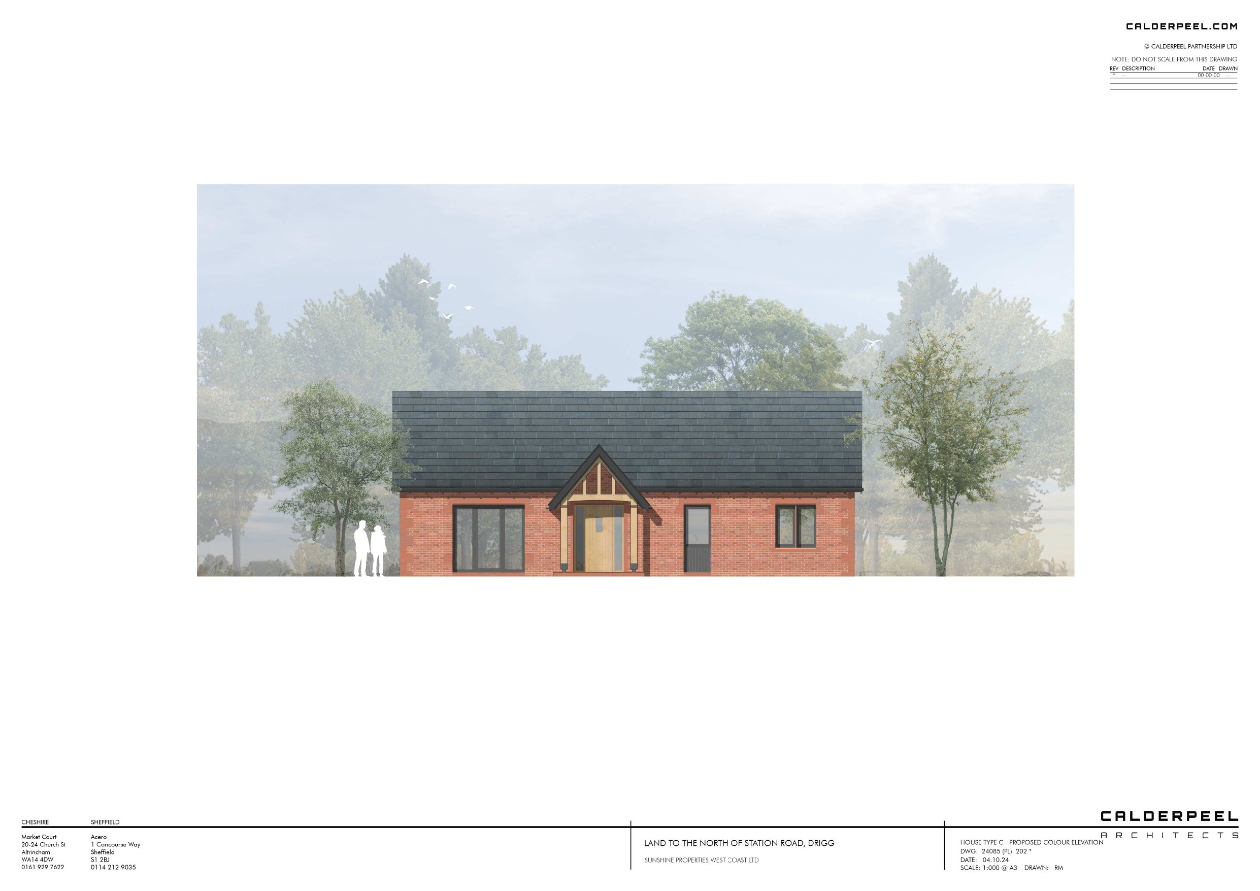
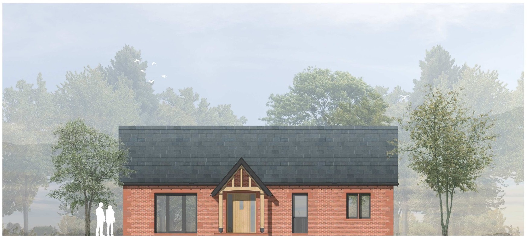
Plot 5 - House Type C (3 bed bungalow) 1,350 sq ft Guide Price £90,000
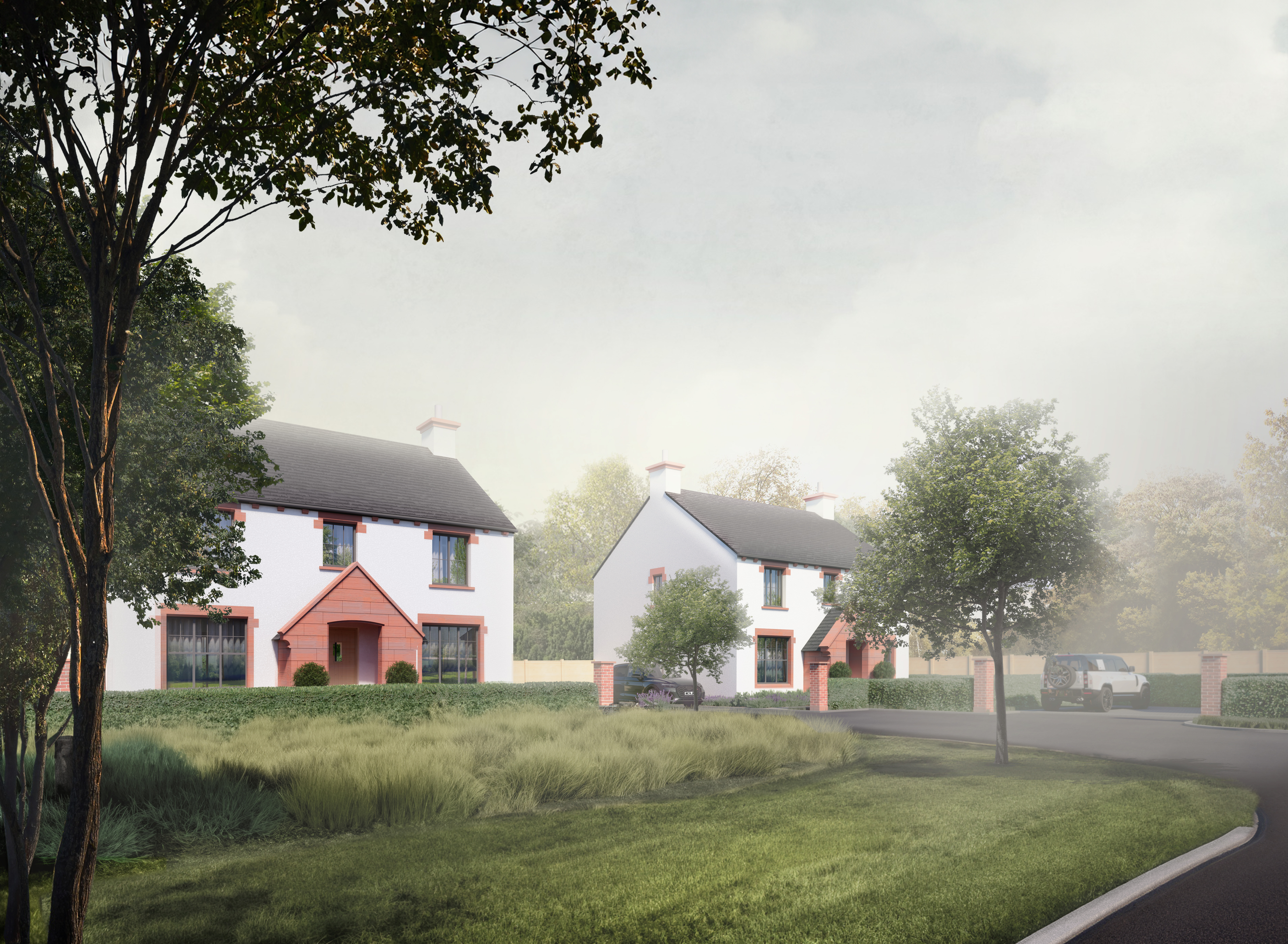
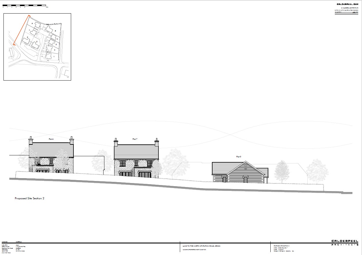
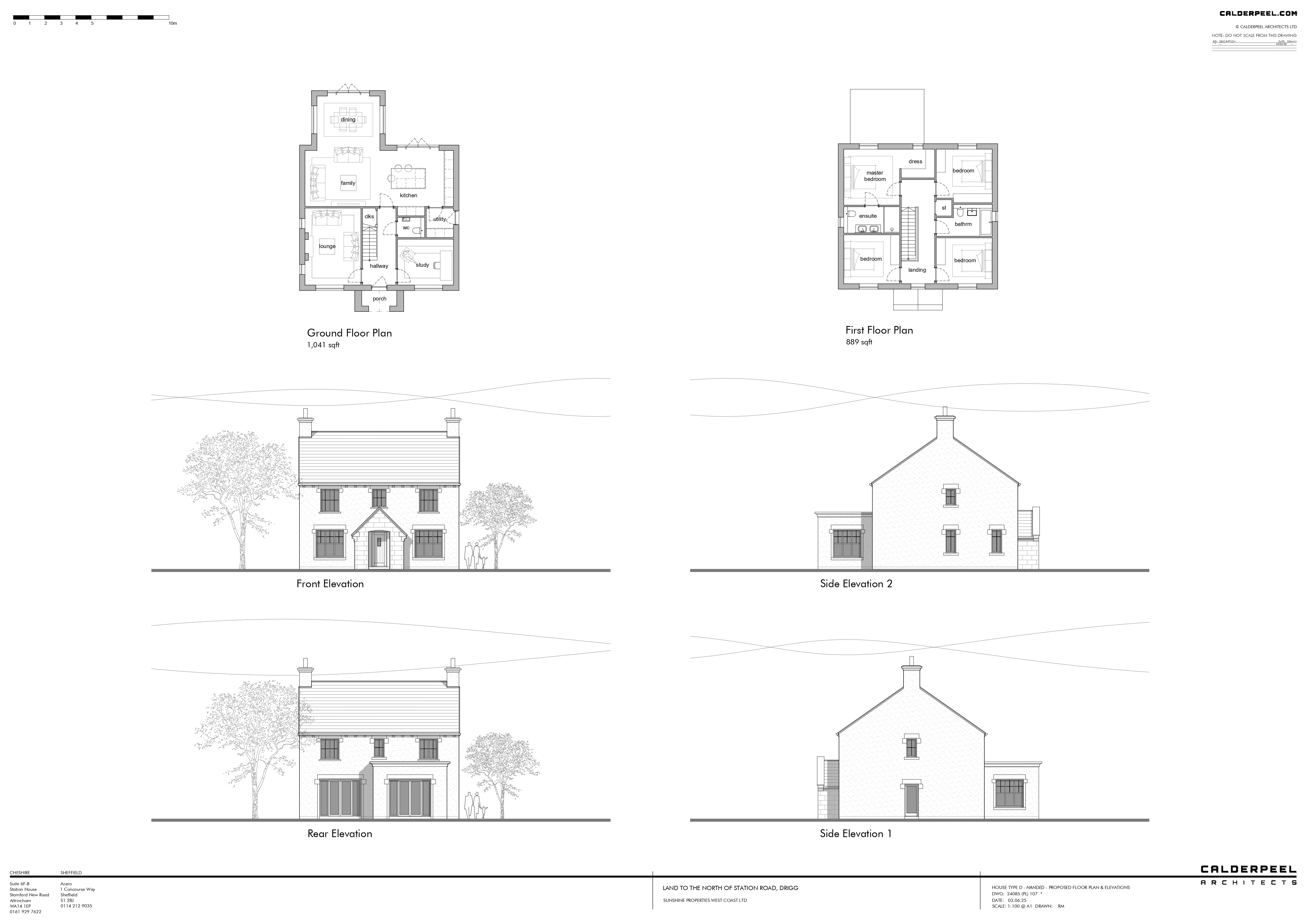
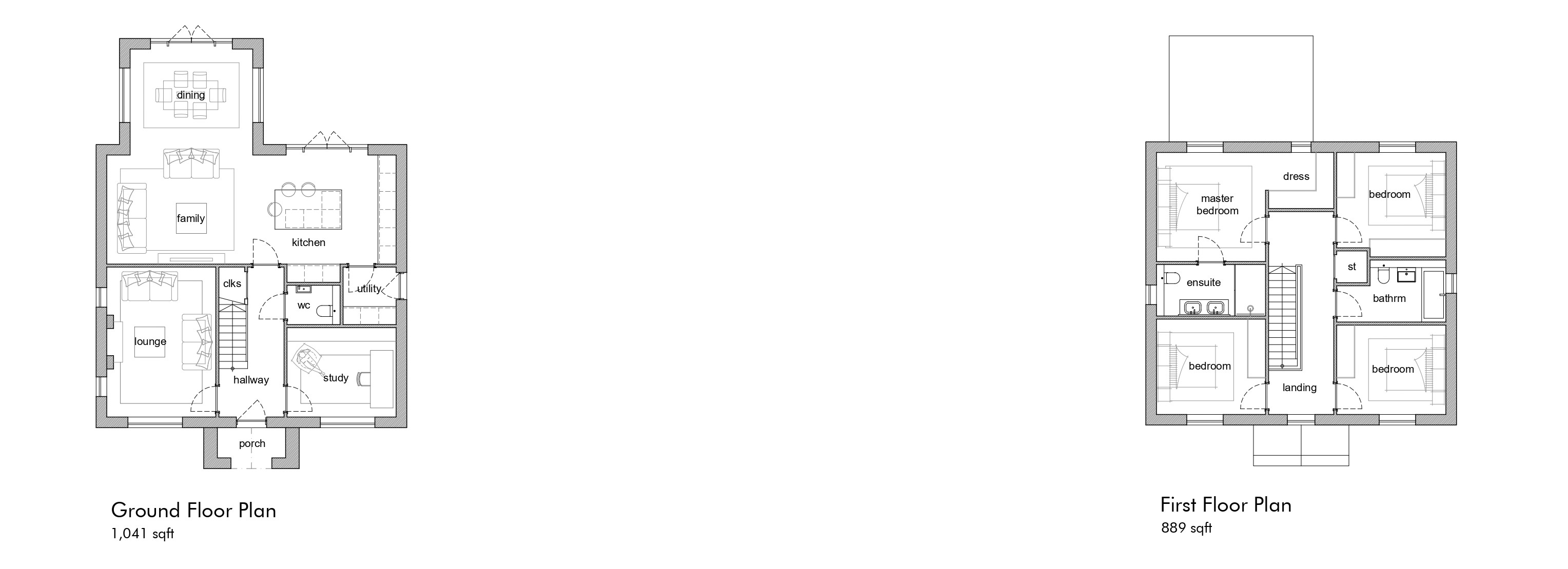
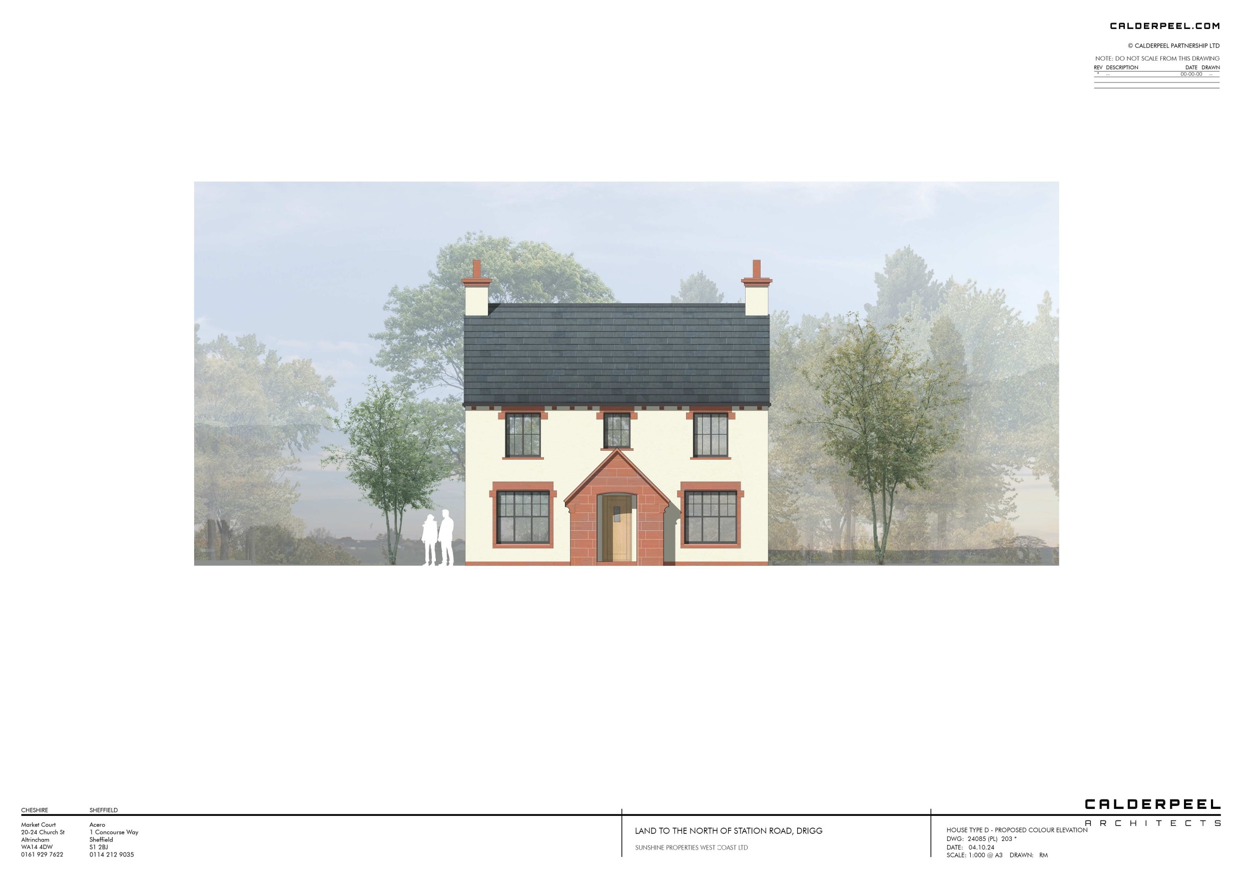
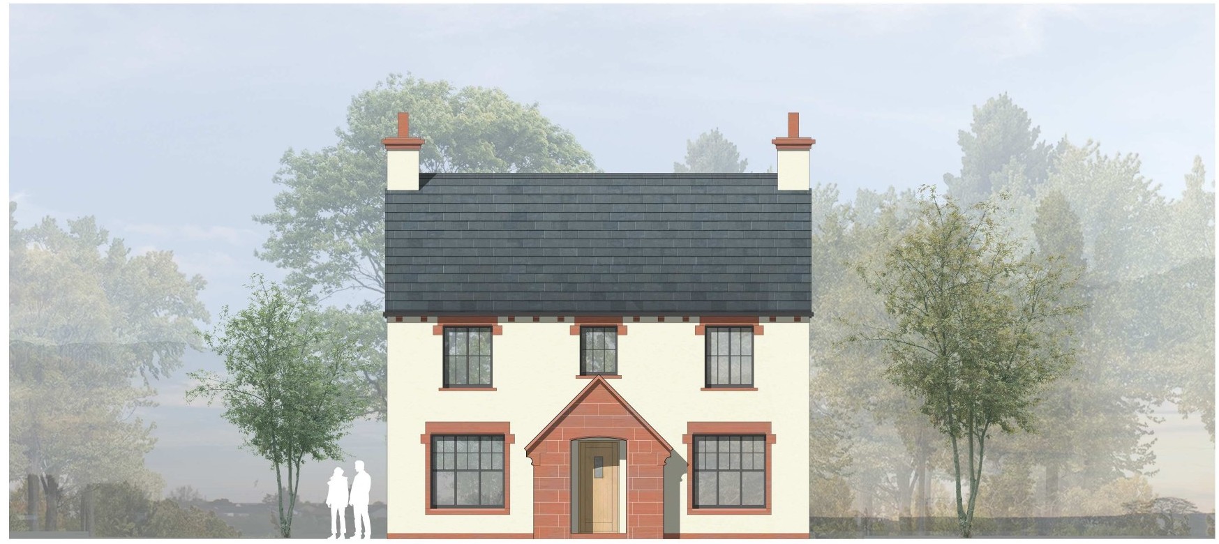
Plot 6 - House Type D (4 bed detached) 1,930 sq ft Guide Price £100,000
Plot 7 - House Type D (4 bed detached) 1,930 sq ft Guide Price £100,000
Plot 8 - House Type C (3 bed bungalow) 1,350 sq ft Guide Price £80,000
Plot 9 - House Type C (3 bed bungalow) 1,350 sq ft Guide Price £90,000
Situation
Drigg is a small village located on the west coast of Cumbria. Drigg offers a village hall, church, train station and craft shop.
Nearby towns include Seascale, accessible by car or train, and providing local amenities such as pubs, primary school, a church and shops. While Drigg is situated in a rural setting, it remains well-connected to larger towns such as Whitehaven and Workington via the A595 which then provides access to the A66 and beyond.
Sellafield – 2.6 miles
Seascale – 3 miles
Whitehaven – 15 miles
Carlisle – 50 miles
Access
Access can be taken directly from Station Road (B5244)
The What3words code for the land is: ///positive.focal.advantage
The nearest postcode is CA19 1XH
Directions
From Whitehaven and the North, head south on the A595 toward Egremont for approximately 12 miles. Just after passing Holmrook, turn right onto the B5344, following signs for Drigg. Continue along the B5344 for approximately 3 miles. Upon reaching the junction with Station Road, the land is located on the right-hand side.
Description
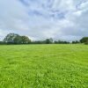
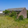
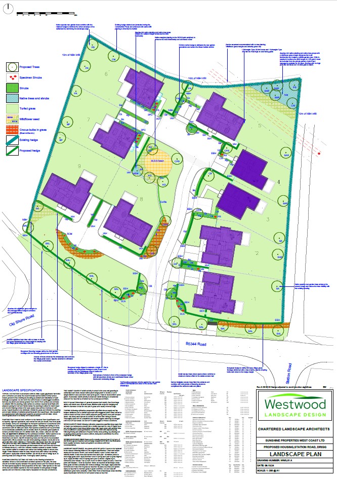
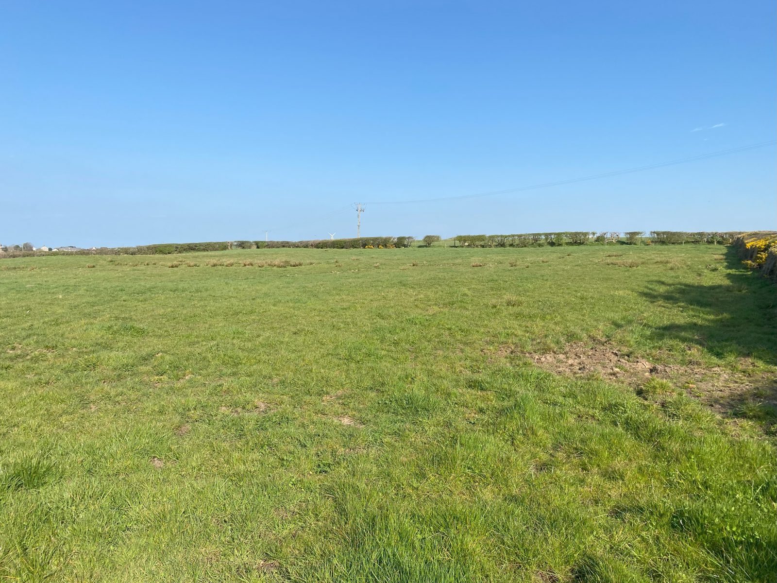
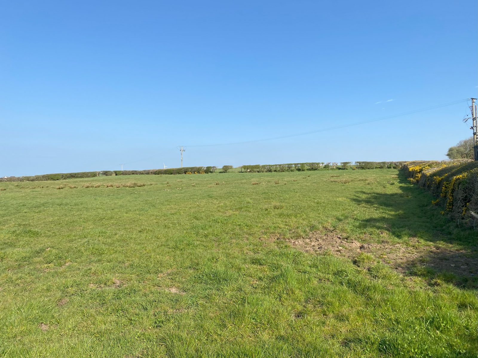
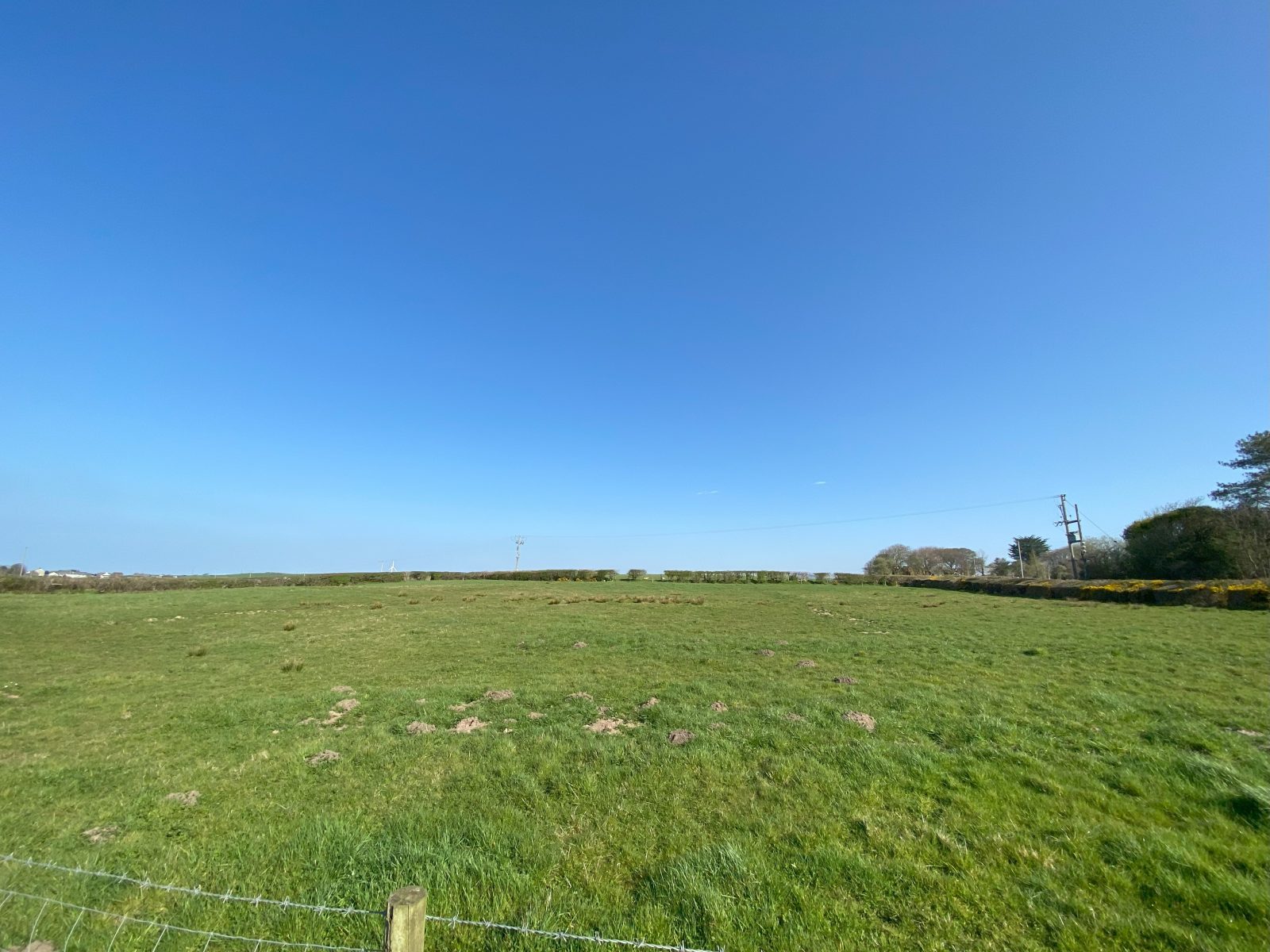
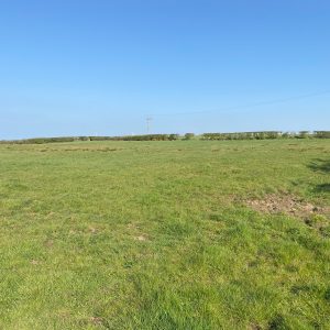
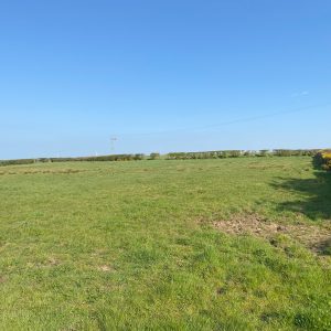
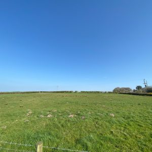
The land extends to approx. 1.75 acres (0.71 hectares) or thereby and is situated north of Station Road in the village of Drigg, Cumbria and benefits from full planning permission for nine residential dwellings.
The land is relatively flat and benefits from roadside access. There is also an access lane to the east and fields to the northern and western boundaries. The land is currently used as agricultural grazing land.
In October 2023 outline planning permission was granted for residential development of 9 dwellings, planning reference 4/22/2070/0O1.
Reserved matters for access, appearance, landscaping, layout, and scale were granted under planning reference 4/25/2079/0R1 dated 30th January 2026.
Additional CGI drawings and plans can be provided up request.
Planning
The full details in relation to planning reference 4/22/2070/0O1 and 4/25/2079/0R1 can be provided upon request from the Selling Agent.
Prospective purchasers should make their own investigations and enquiries and seek relevant professional advice accordingly.
Services
It is up to prospective interested parties to make their own enquiries with regards to services for the property. The Vendor has had prices from a service provider of gas, water, electricity and fibre broadband. Additional information available upon request.
Sporting Rights
Information available upon request.
Mineral Rights
Information available upon request.
Local Authority
Cumberland Council
Civic Centre
Rickergate
Carlisle, CA38QG
Tel: 0300 373 3730
Plans, Areas and Schedules
These are based on the Ordnance Survey and Title Deeds and are for reference only. They have been carefully checked and computed by the selling agents and the purchaser shall be deemed to have satisfied themselves as to the description of the property and any error or mis-statement shall not annul the sale nor entitle either party to compensation in respect thereof.
Viewing
By strict appointment with the Selling Agents: Davidson & Robertson Ltd. Telephone: 01900 268633 or via email: sales@drrural.co.uk All viewings are to be arranged with the selling agents.
Date of Entry
By mutual agreement.
VAT
It is understood that VAT is not to be charged on the property.
Solicitor
FAO Emma Williams
Brockbanks Solicitors
6 Borrowdale Road
Keswick, CA12 5DB
Email: EFW@brockbanks.co.uk
Tel: 017687 72125
Tenure
The property is offered for sale as a freehold property.
Flooding
Flood risk assessments were carried out as part of the planning process and prospective purchasers should review the details available on the planning portal. Additional information available upon request,
Offers and Anti-Money Laundering (AML) Regulations
Under The Money Laundering, Terrorist Financing and Transfer of Funds (Information on the Payer) Regulations 2017 we are required to carry out money laundering checks on purchasers. To facilitate this and to proceed promptly with submitting an offer, the following documentation must be provided to us in advance (i.e. prior to or alongside the formal offer submission):
- Valid proof of identification
- Proof of current address
- Evidence of purchase method (e.g., Mortgage in Principle, Proof of Funds)
Upon verbal acceptance of an offer, we require to verify the purchaser’s identity and use an online verification service provider to do so. We cannot enter a business relationship with a purchaser until they have been identified. Failure to provide required identification may result in an offer not being considered.
![]()
![]()
![]()