
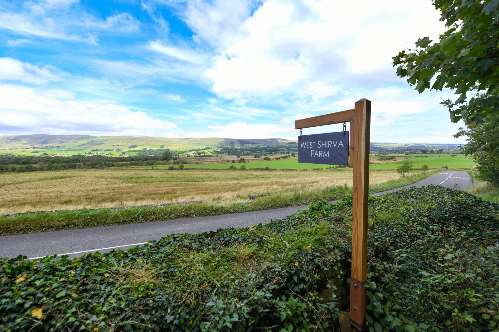
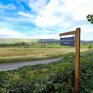
West Shirva Farm
West Shirva Farm Twecher Kilsyth G65 9LJ
A fantastic opportunity to acquire a mixed livestock farm extending to approximately 251.26 acres, equipped with a centrally located steading
with a good range of buildings and a four-bedroom farmhouse.
The property benefits from;
■ A strategic location
■ Possibilities for woodland creation and for bio-diversity net gain projects.
■ Wetland areas that offer a chance for habitat management
Available as a Whole
Situation
West Shirva Farm is situated 3 miles Northeast of the town of Kirkintilloch and 3.5 miles Southwest of Kilsyth
and is within commuting distance from cities such as Glasgow and Stirling.
Access
Access can be taken directly from the B8023.
Directions
From the M80 motorway take junction 5 and follow the B8048 through 5 roundabouts before turning right towards Twechar. Follow the road for 1.3 miles to get onto Mainstreet. Follow Mainstreet until you reach the B8023. Take a left turn at the end of main street and travel along the B8023 for 0.6 miles and West Shirva Farm is on the left.
What3words address - defenders.bead.guilty
Historical Note
The land at West Shirva is bisected east to west by the B8023 which lies along the line of the Roman Antonine
Wall which is designated as a World Heritage Site. The Antonine Wall, built by the Romans in the mid-2nd century AD, was the northernmost frontier of the Roman Empire in Britain. Constructed under the orders of Emperor Antoninus Pius around 142 AD, it stretched approximately 39 miles (63 kilometers) across what is now central Scotland, from the Firth of Forth to the Firth of Clyde. Unlike the stone-built Hadrian’s Wall to the south, the Antonine Wall was primarily made of turf atop a stone foundation, accompanied by a large ditch and fortifications. The wall marked the empire’s attempt
to extend its control further into Caledonia (modern Scotland), but it was only occupied for about 20 years before the Romans retreated back to Hadrian’s Wall. Today, the remnants of the wall are a UNESCO World Heritage Site, highlighting its significance as a symbol of Roman ambition and engineering.
Description
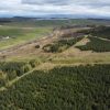
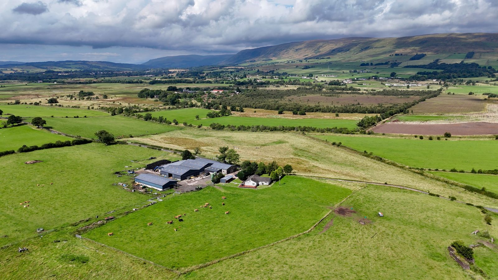
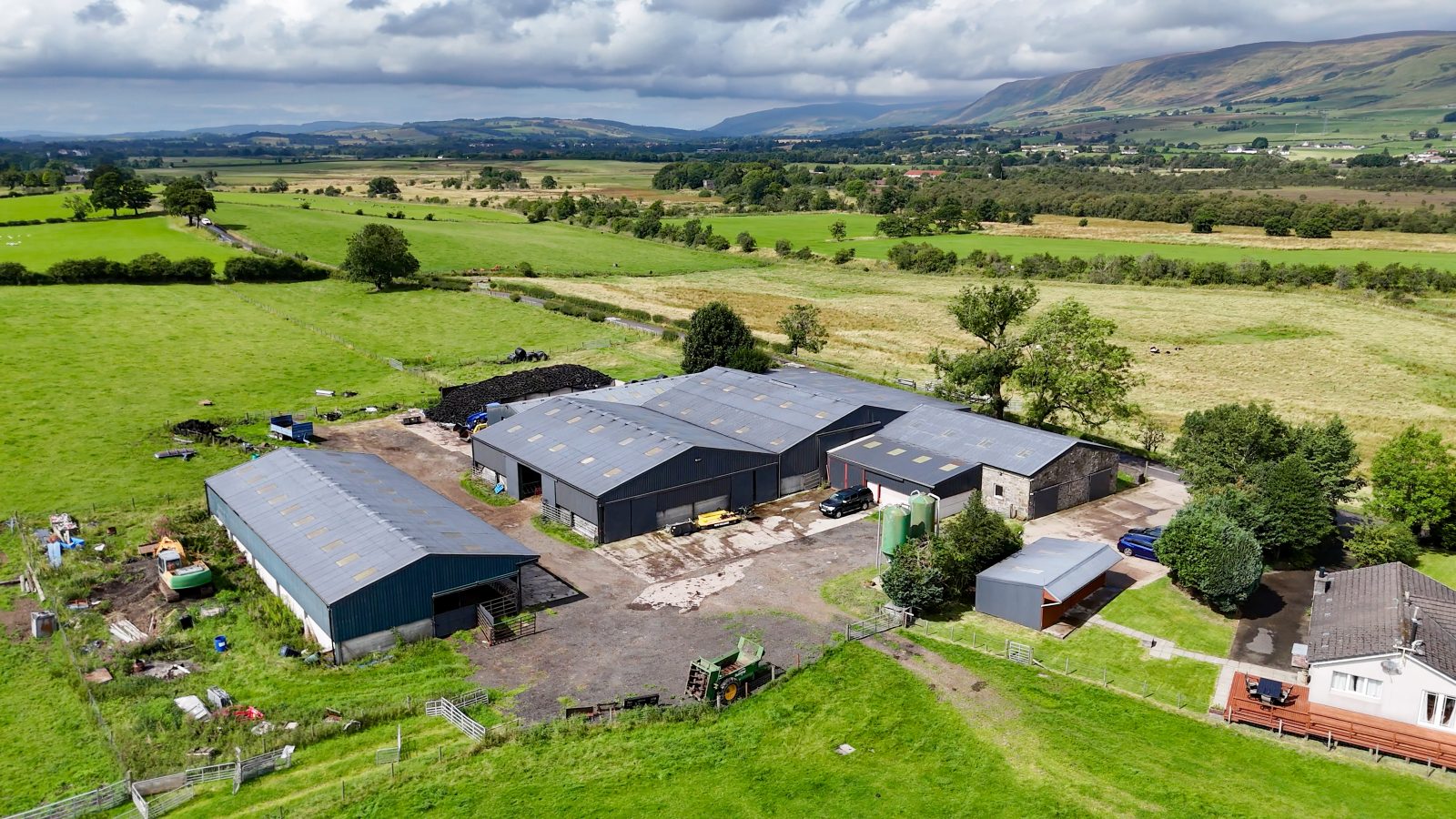
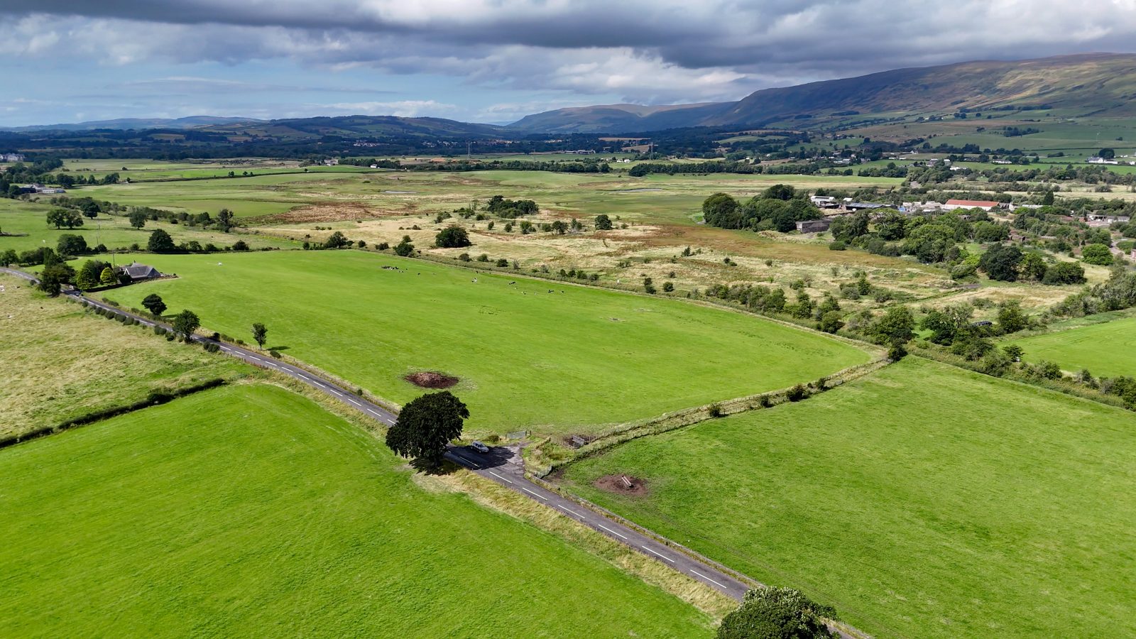
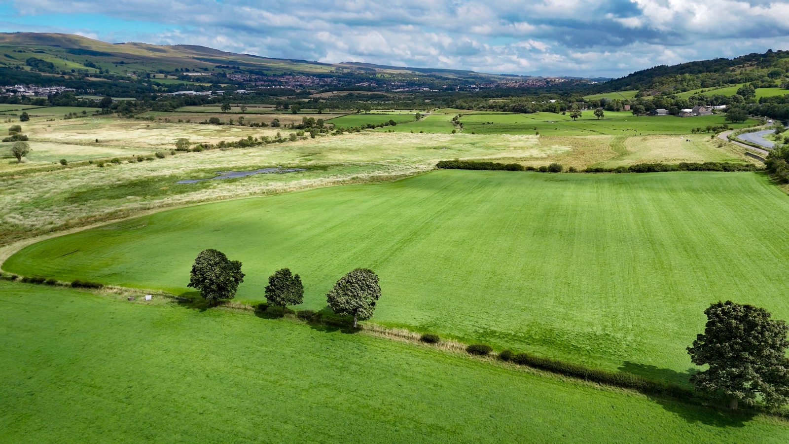
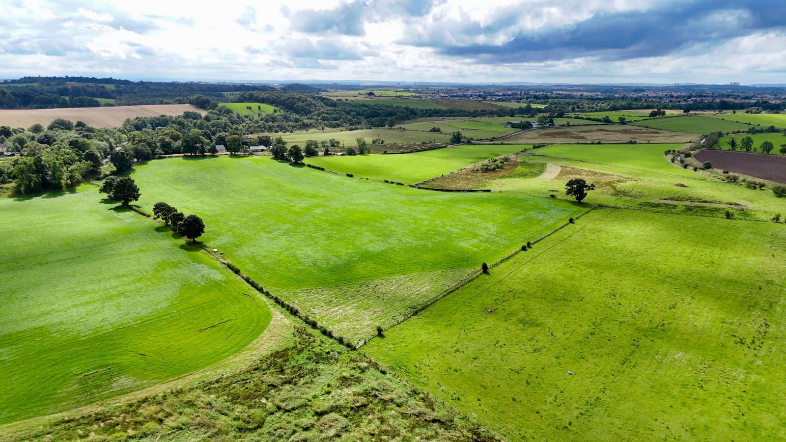
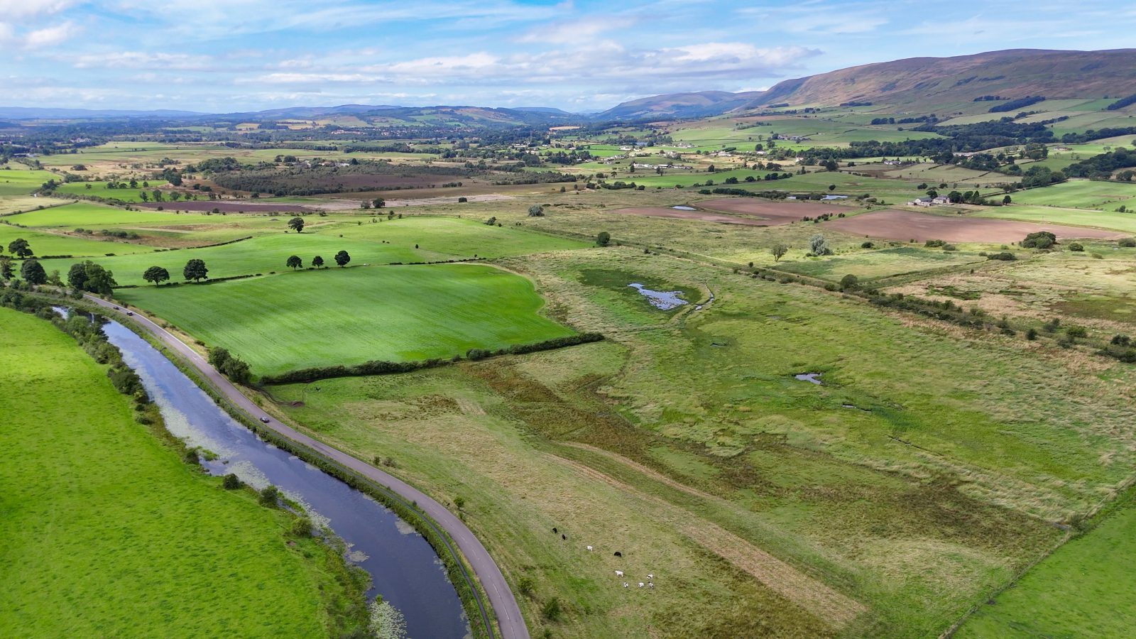
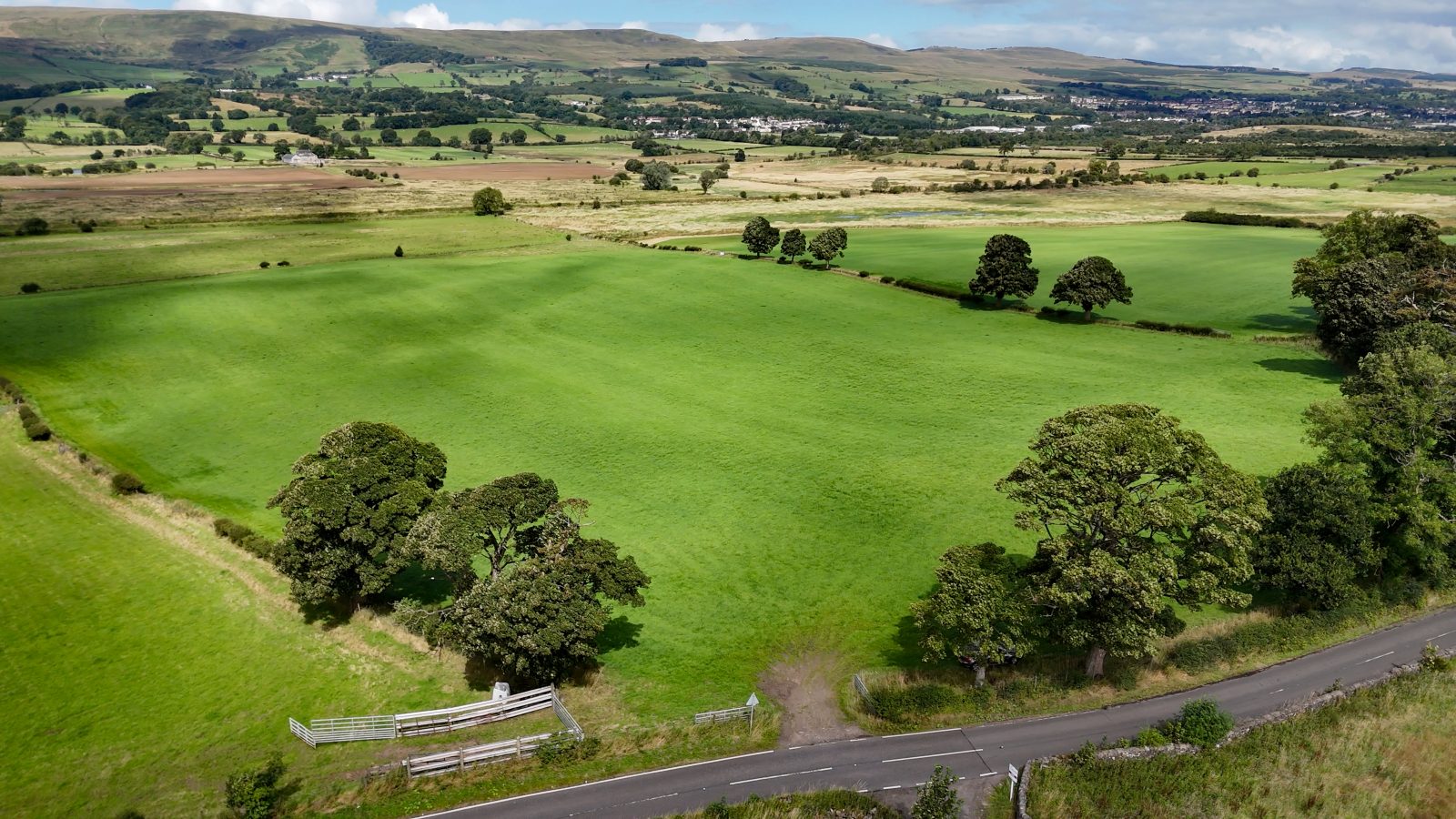
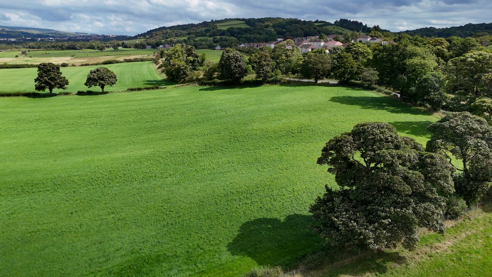
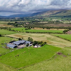
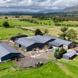
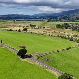
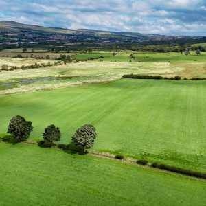
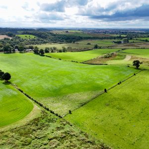
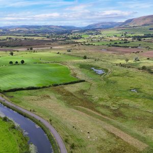
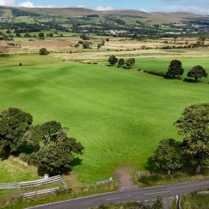
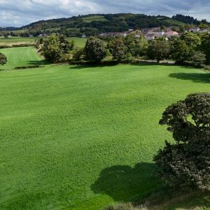
West Shirva is a mixed livestock farm which extends to approximately 251.26 acres. The land predominately comprises of permanent pasture with some areas of ground capable of forage production and rough grazing.
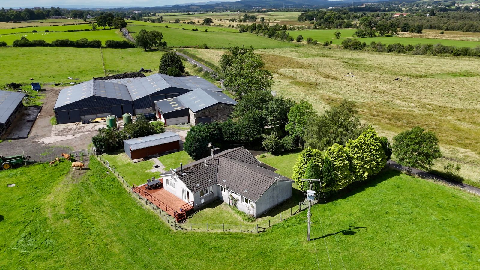
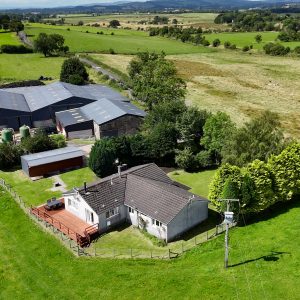
The farm has a centrally located steading with a good range of buildings and there is a 4-bedroom farmhouse adjoining the steading.
The property is in a strategic location, being located 3 miles Northeast of the town of Kirkintilloch and 3.5 miles Southwest of Kilsyth, it is within commuting distance from cities such as Glasgow and Stirling. West Shirva offers possibilities for woodland creation and for bio-diversity net gain projects. There are
approximately 20 acres that have been identified as areas for potential tree planting. The wetland areas offer a chance for habitat management, and this is seen by developers as an opportunity to off-set their activities elsewhere. A copy of the habitat survey is available upon
request from the selling agents.
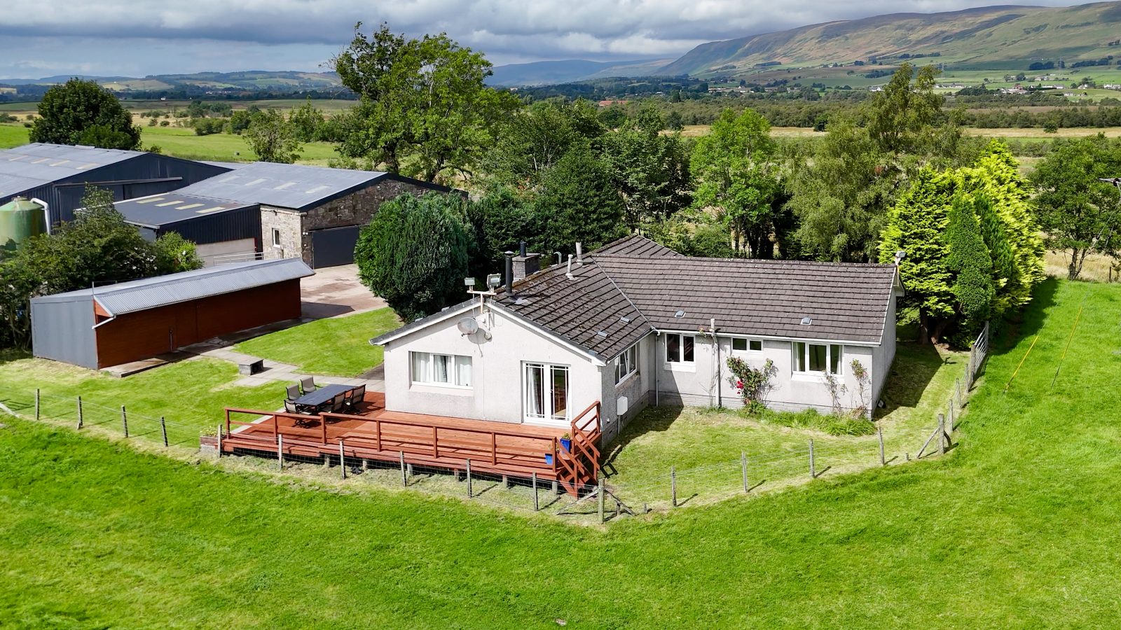
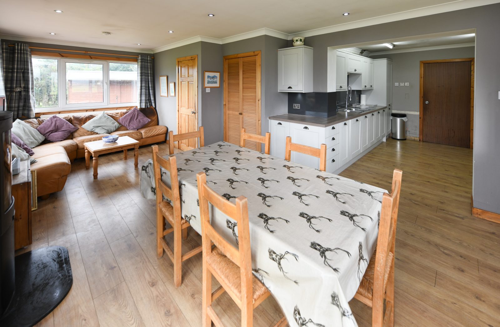
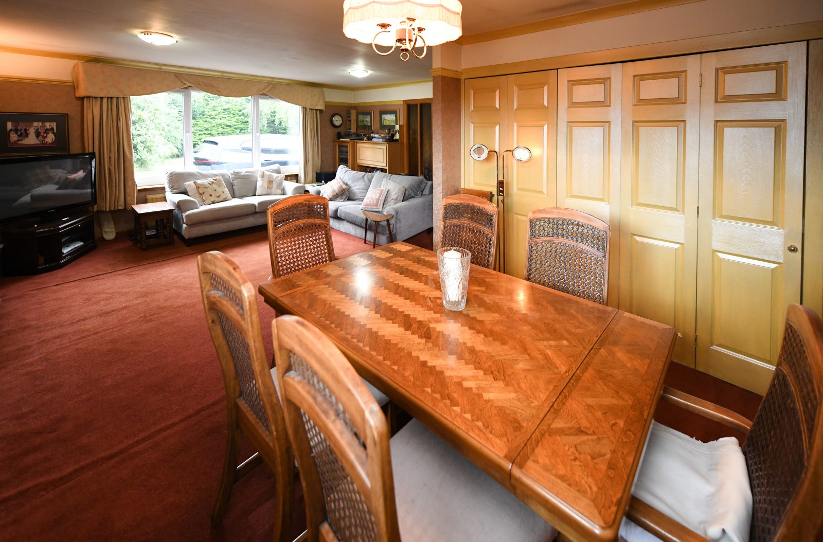
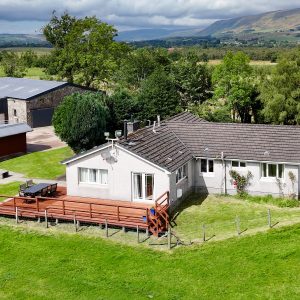
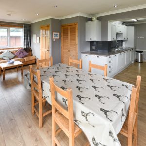
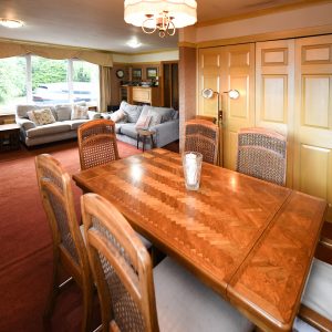
Farmhouse
West Shirva Farmhouse is a large timber kit bungalow with a tile roof built in the 1980’s with an extension
added in the 1990’s. The dwelling is situated at West Shirva steading but benefits from its own access and some screening from the steading.
The property features a fitted kitchen, lounge, dining room, three double bedrooms, a single bedroom, a
utility room and one bathroom. The property is in good condition throughout.
West Shirva Farmhouse also benefits from a garden area wrapping around the property, with a wooden deck to the rear and substantial space for car parking.
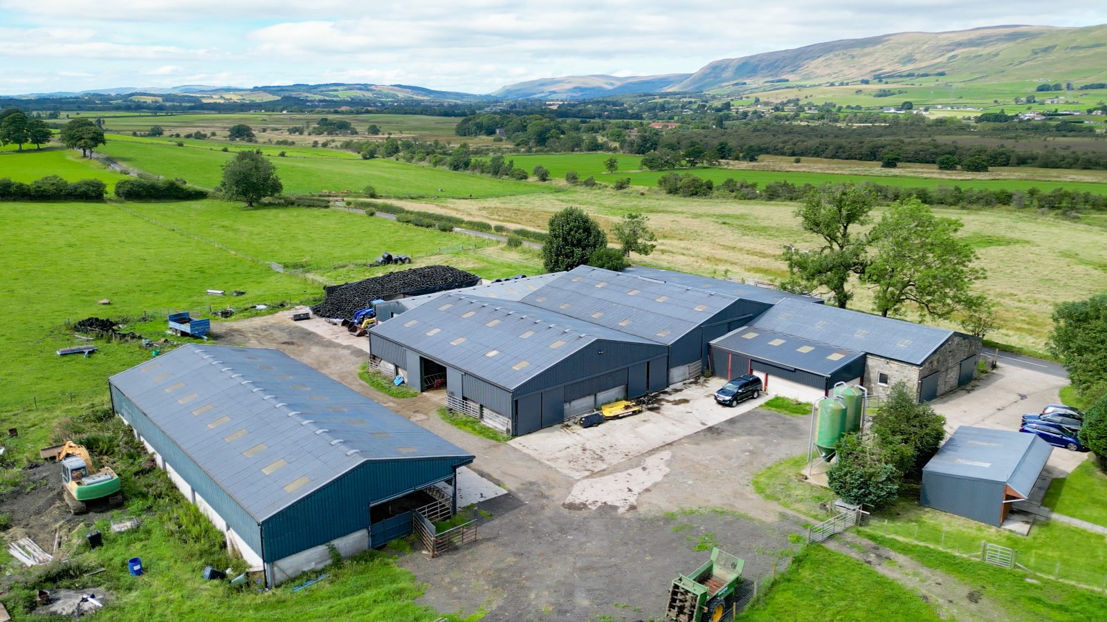
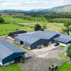
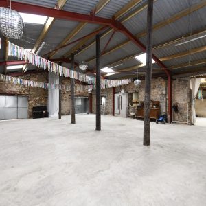
West Shirva Farm Buildings
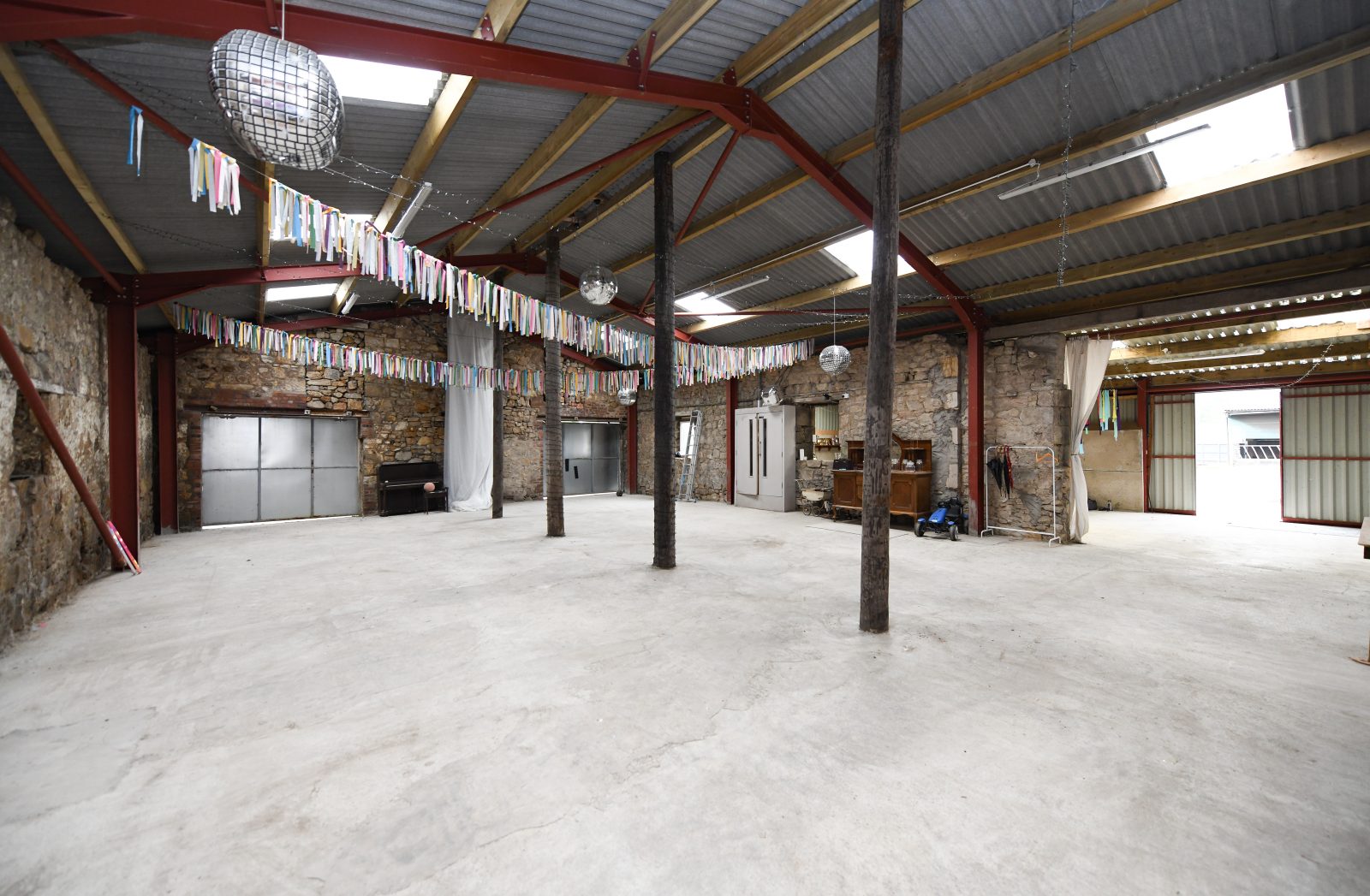
1. Storage Shed
This is a traditional stone built shed with a timber frame, box profile cladding, concrete floor and high-level roof.
The building also benefits from two secure steel doors, rewired electricity supply and water supply. The shed leads into a lean to and is in good condition.
2. Lean To
The lean to is a new two bay steel framed lean to added to the south side of the storage shed. The shed benefits
from concrete panel walls with box profile side, roof cladding, sliding doors, concrete flooring and electricity and water supplies.
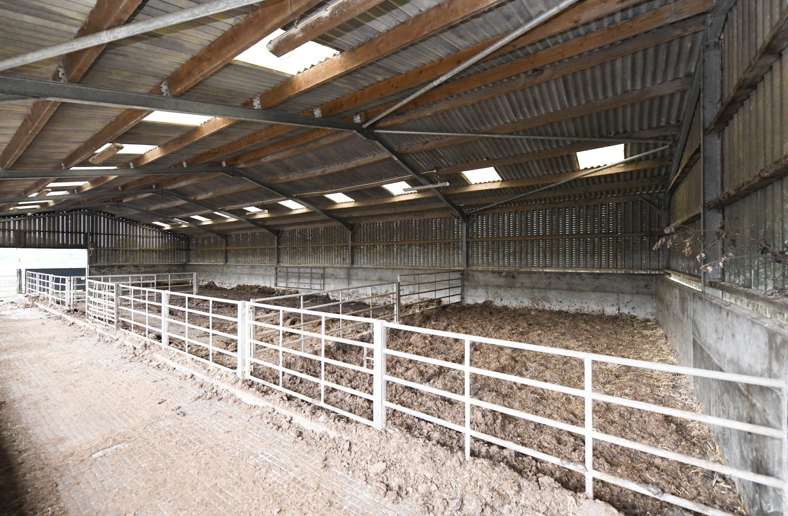
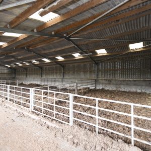
3. Cattle Court
The first cattle court is a five bay steel portal framed cattle court with corrugated panel roof and skylights,
with concrete panelled walls below ventilated profile cladding. There are water and electricity supplies available with a concrete floor and cattle
accommodation provided by straw courts. There is an open feed passage and concrete floor to the front of the
shed with an overhang.
4. Cattle Court
The second cattle court is a five bay steel portal frame cattle shed with wooden beams and corrugated cement
fibre roof with skylights in each bay. The walls are made from two concrete panels with some ventilated cladding
above. The shed has a central feed passage and benefits from water and electricity supplies.
5. General Purpose Shed
This is a secure steel portal framed four bay storage and machinery shed. The rear elevation is two concrete
panels and corrugated sheeting with the western elevation joining to the sileage pit. There is an electric
roller door and pedestrian access point to front.
6. Silage Pit
The double silage pit has a steel frame, and walls formed from two concrete panels. The pit benefits from an
effluent drainage system.
7. Cattle Shed
This cattle shed is a mix of steel portal frame and traditional stone construction cattle shed with concrete
floor and benefits from water and electric supplies.
8. Processing Shed
The processing shed is a small timber mono-pitch shed that was previously used for egg processing. 3 of the
walls and the roof are made from corrugated sheeting.The frontage is constructed from wooden panels and
there is a concreted area on the outside. The building benefits from electric and water supplies.
Land
The land extends to approximately 251.26 acres (101.68 hectares) and is predominantly used for grazing of cattle
and sheep or silage/hay production. The Land was run organically until recent years, and since the transition,
some drainage works have been undertaken.
The land at the Property is predominantly class 3.1/4.2 land as classified by the James Hutton Institute’s Land Capability for Agriculture as defined
below:
Class 3.1 Land – Land capable of producing consistently
high yields of a narrow range of crops and/ or moderate
yields of a wider range. Short grass leys are common.
Class 4.2 Land – Land capable of producing a narrow
range of crops, primarily on grassland with short arable
breaks of forage crops.
Basic Payment Scheme (BPS) & IACS
The land is registered under the Basic Payment Scheme and all the land is allocated as region 1.
The payment for 2024 will be retained by the vendors. The entitlements to the BPS are to be included in the sale.
Photos taken: August 2024
Particulars prepared: February 2025
Offers and Anti-Money Laundering (AML) Regulations
Formal offers, in the acceptable Scottish form, should be submitted through a Scottish Solicitor to the Selling Agent. Under The Money Laundering, Terrorist Financing and Transfer of Funds (Information on the Payer) Regulations 2017 we are required to carry out money laundering checks on purchasers. To facilitate this and to proceed promptly with submitting an offer, the following documentation must be provided to us in advance (i.e. prior to or alongside the formal offer submission):
- Valid proof of identification
- Proof of current address
- Evidence of purchase method (e.g., Mortgage in Principle, Proof of Funds)
Upon verbal acceptance of an offer, we require to verify the purchaser’s identity and use an online verification service provider to do so. We cannot enter a business relationship with a purchaser until they have been identified. Failure to provide required identification may result in an offer not being considered.
Broadband/Mobile signal
We understand that broadband & mobile reception is available. Buyers are advised to visit OFCOM website for an indication of supply and speeds: //checker.ofcom.org.uk/en-gb/broadband-coverage and carry out their own further due diligence.
UNDER OFFER


![]()
![]()
![]()